


![]()
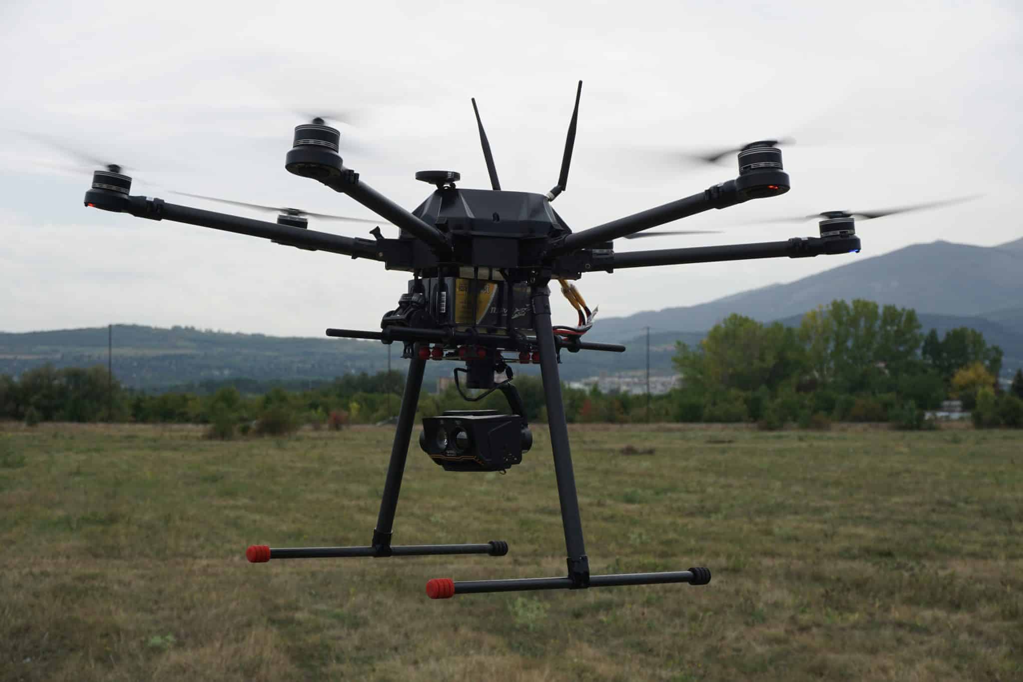
ARCAS 700TM is one of the newest and most innovative products from Aero Vision. With its small size and compactness, it also features exceptional strength and long flight time – unattainable by most electric powered multirotors worldwide.
It has the ability to carry various thermal cameras, launch various payloads, making it highly suitable for defense and security, search and rescue operations, surveillance and monitoring, precision agriculture.
ARCAS 700TM has a flight time of 2 hours empty and 50 min. with 5 kg payload.
![]()
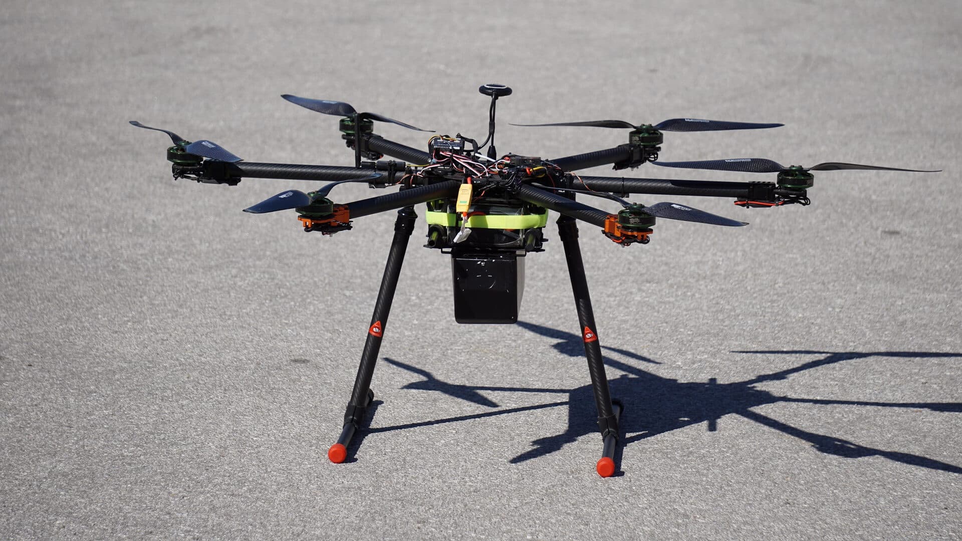
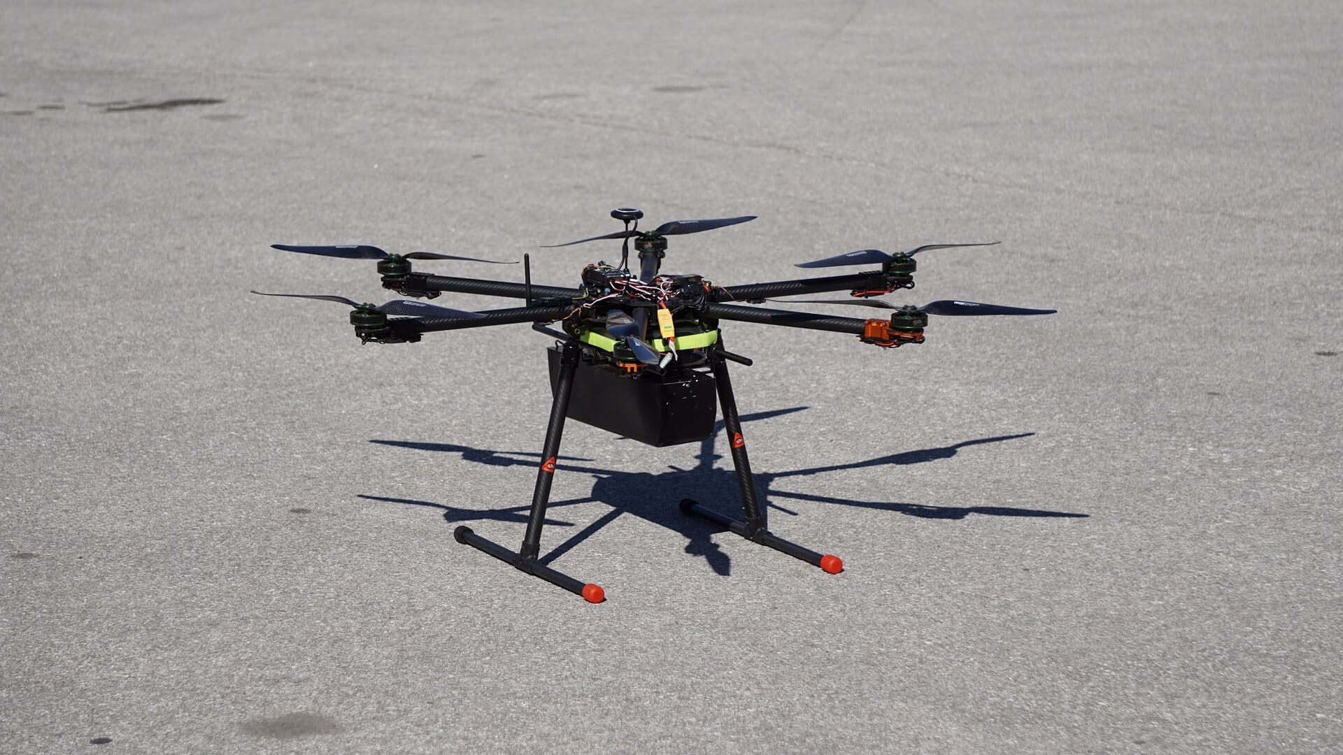
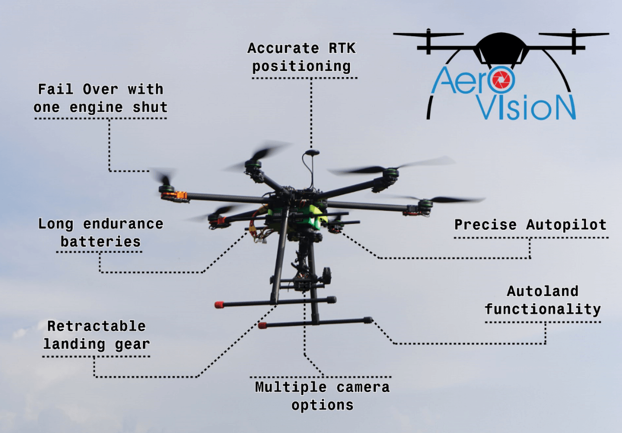
ARCAS 1100TM is one of the latest and innovative products from Aero Vision. It is distinguished by its exceptional strength and long flight endurance – unreachable for most of electrically driven multirotors.
One of its important features is the high payload and capabilities to carry different thermal cameras, dropping payloads which makes it suitable for security and defense applications, Search And Rescue operations, surveillance and monitoring.
ARCAS 1100TM has a flight time of 1 hour empty and efficient flight of 30 min with 10 kg of payload.


![]()
ARCAS 2300™ is the latest and most innovative product from Aero Vision. It is distinguished by its exceptional strength and long flight endurance – unreachable for most of the spraying multirotor unmanned aircraft.
The unprecedented positioning accuracy, as well as the reliable and industry-proven autopilot, ensures accurate and safe work in bad weather conditions and high altitudes.
It is suitable for various spraying tasks as it could be equipped with different nozzles to ensure enfficency and high results on the field.
ARCAS 2300™ has normal flight time of 1 hour and efficient spraying of 20 ha/hour.
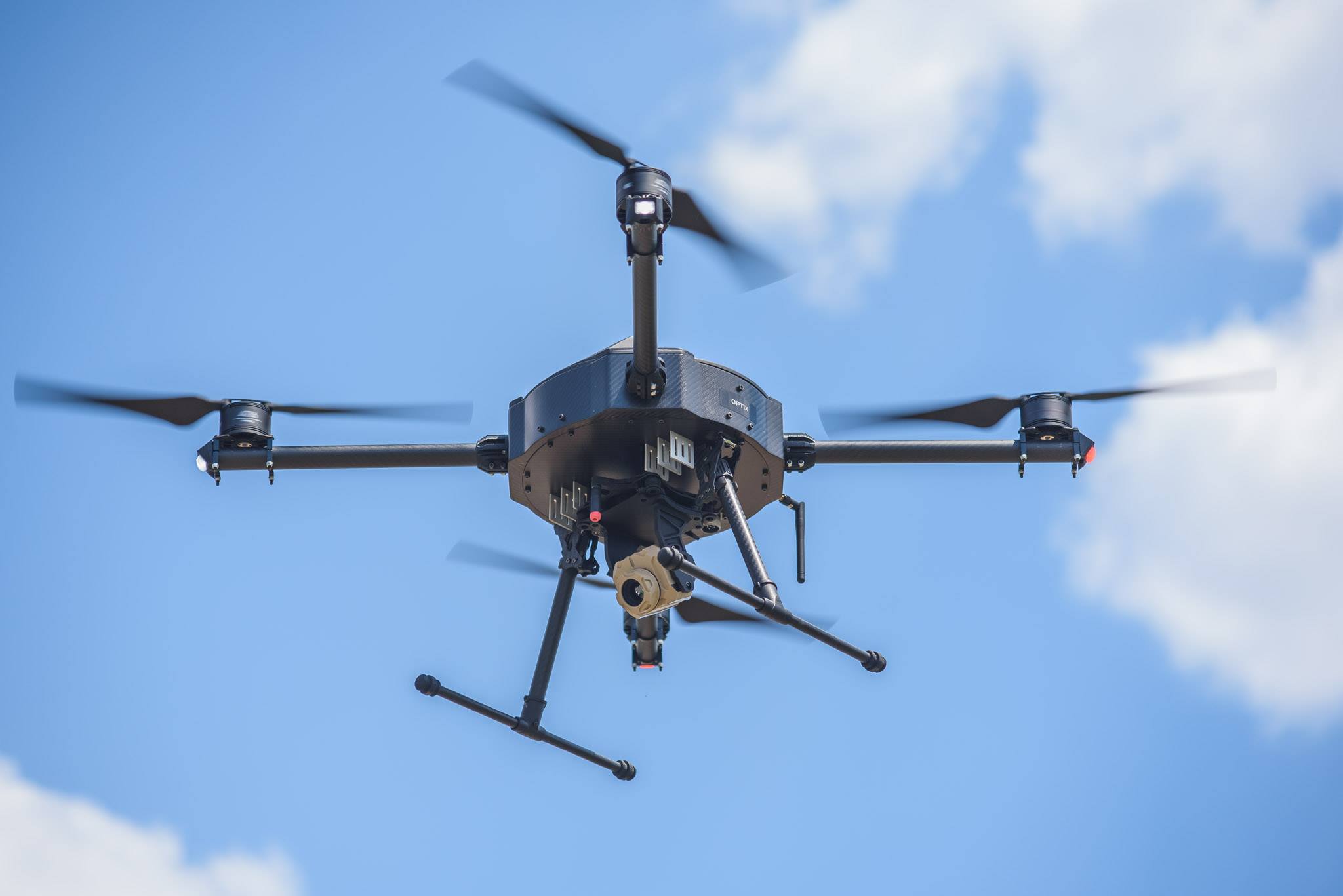
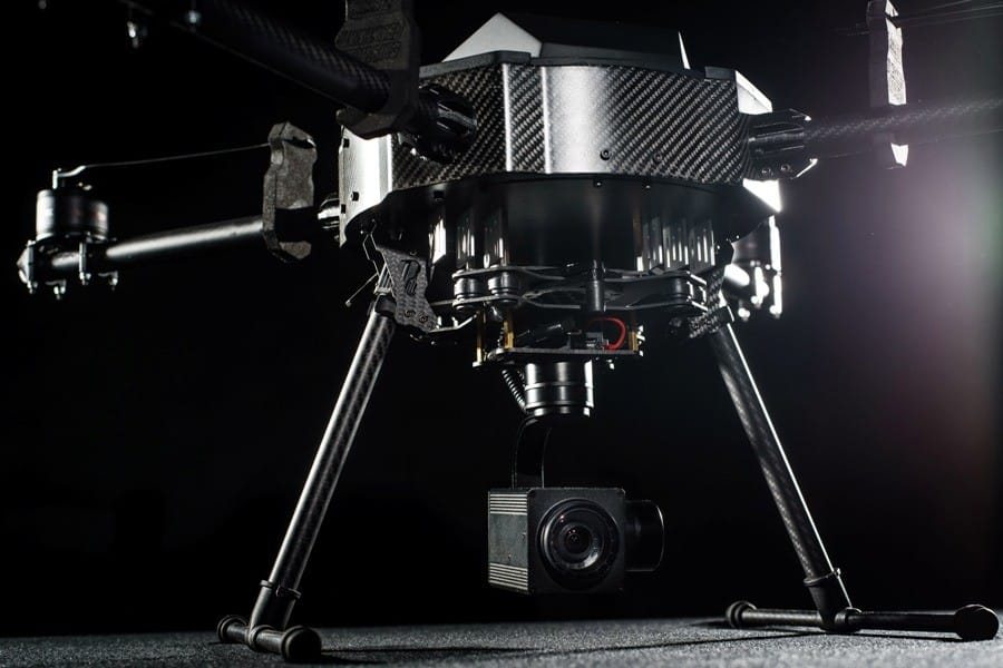
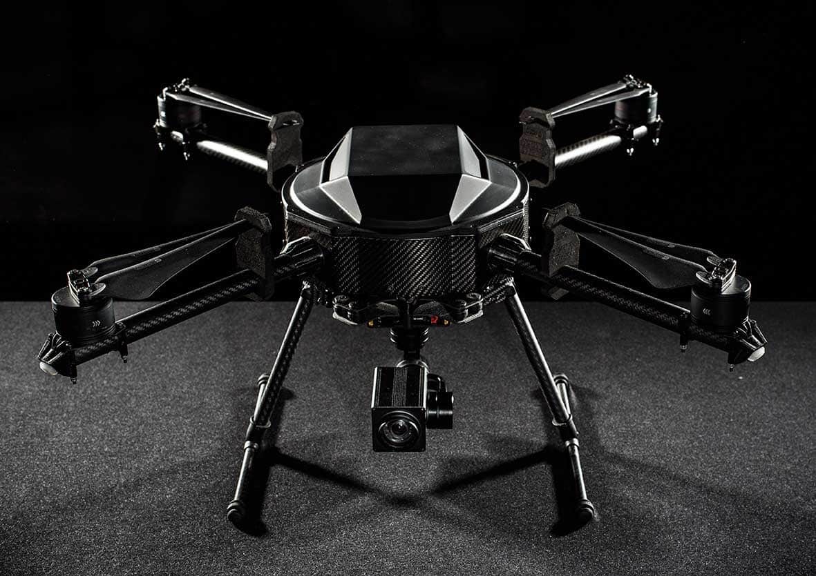
HKR-3 “Hornet” – UAV for special operations
Aero Vision Ltd in a partnership with Unmanned Inquiries Ltd has developed new type of a multirotor. The UAV was designed to meet all of the high-end requirements of Governmental Bodies, like Special Forces of the Police, Security companies, Search and Rescue services, Customs Agencies, Fire brigades.
The HKR-3 is intended to be used in very harsh environment and its durability provides the services with reliable solution for covered operations. Its low- noise profile and small dimensions provides the operator with the capability for fast deployment, ease of operation and deployment behind the enemy lines.
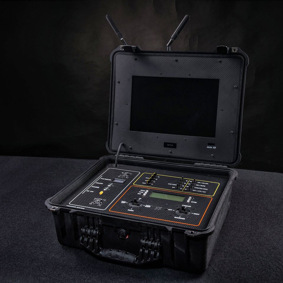
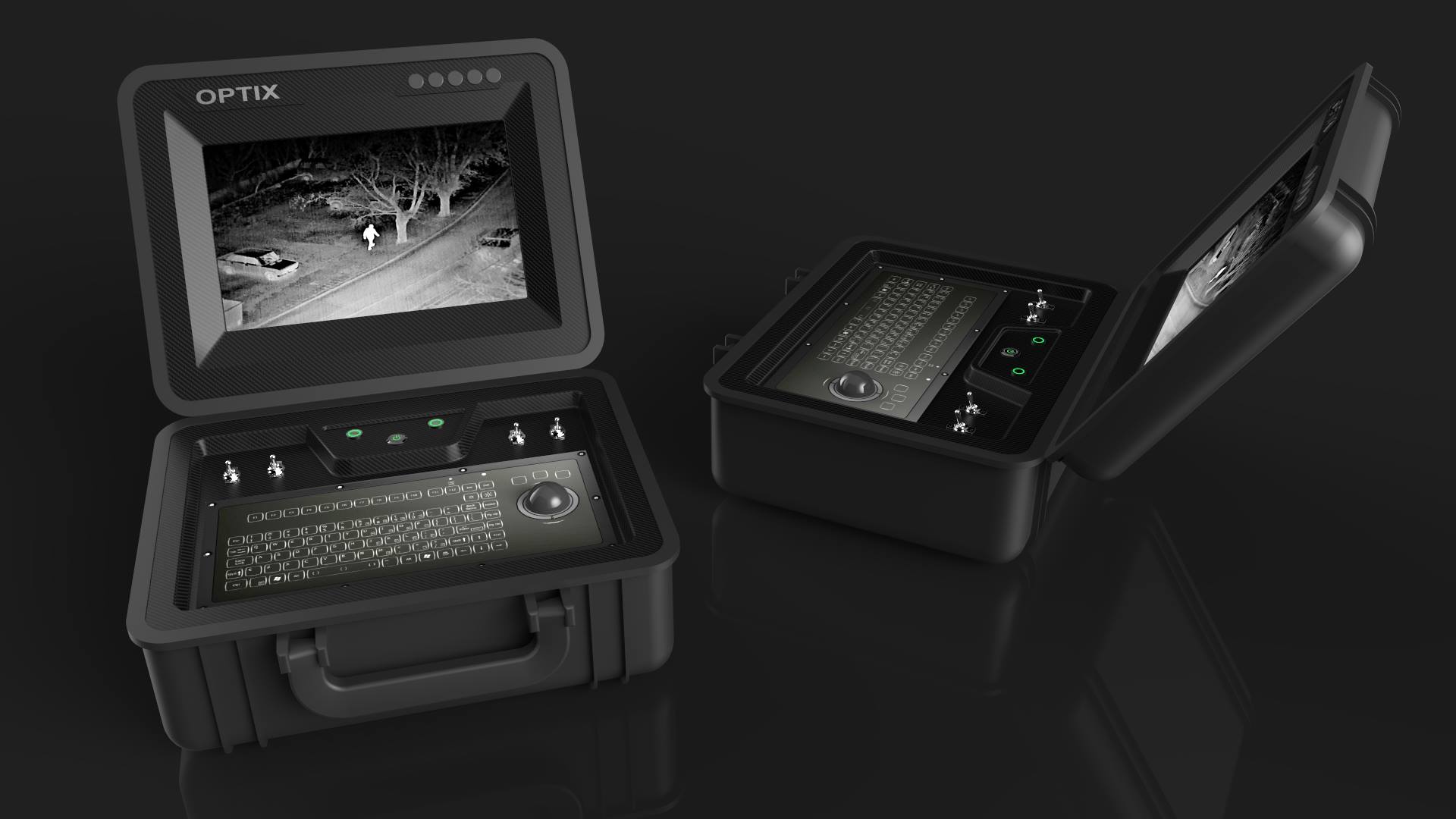
The module design of HKR-3 provides multiple options for payload and equipment, like installation of dual RGB + Thermal camera from Workswell and military grade cameras from Optix. Additionally, HKR-3 could be equipped with different types of flight controllers and autopilots, allowing the use of up to 7 Flight modes, flight planning capabilities for autonomous flight and integrated Ground Control Station. In addition, HKR-3 could be equipped with Long Range Telemetry and military grade encrypted connections for control.


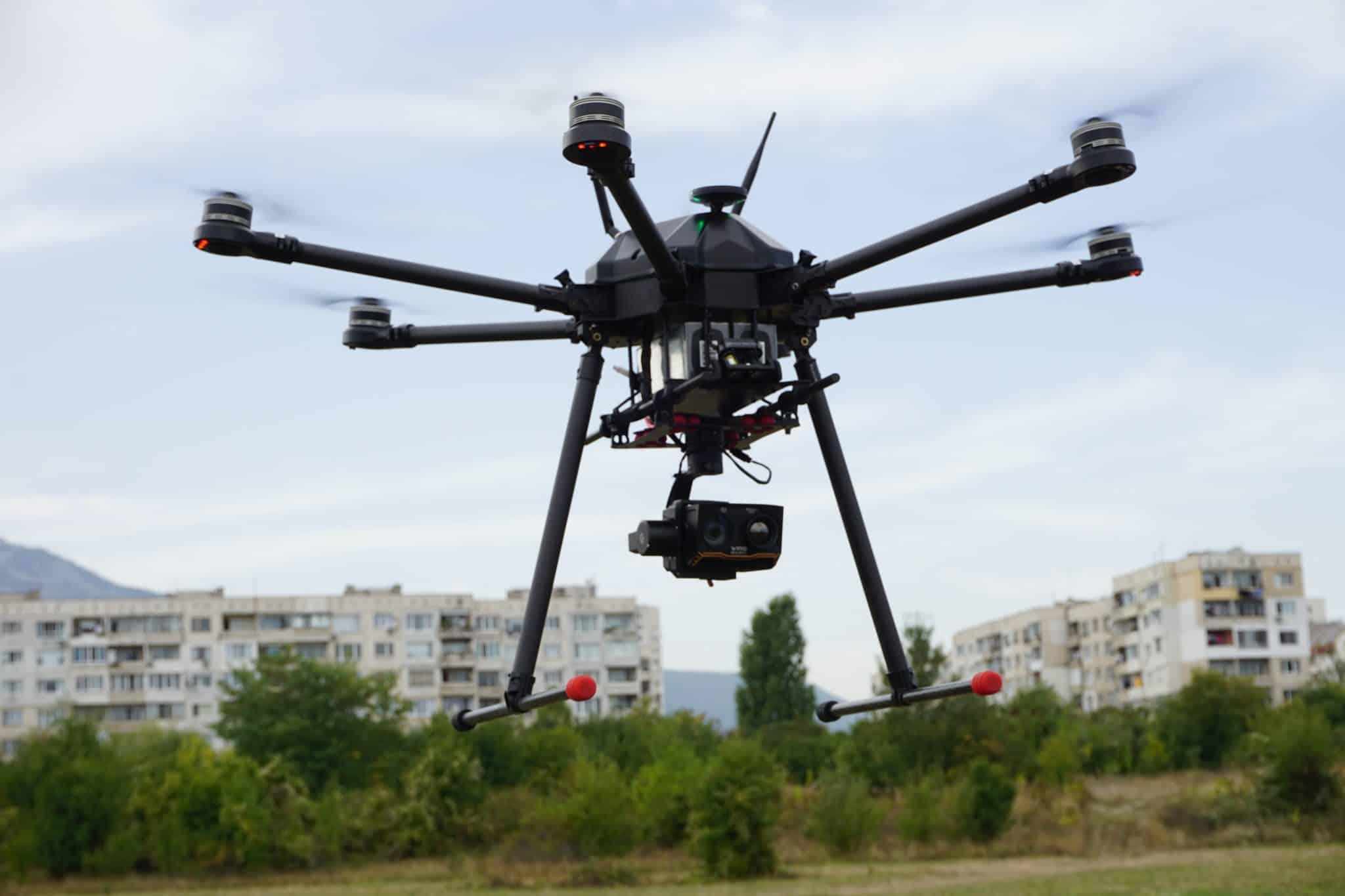

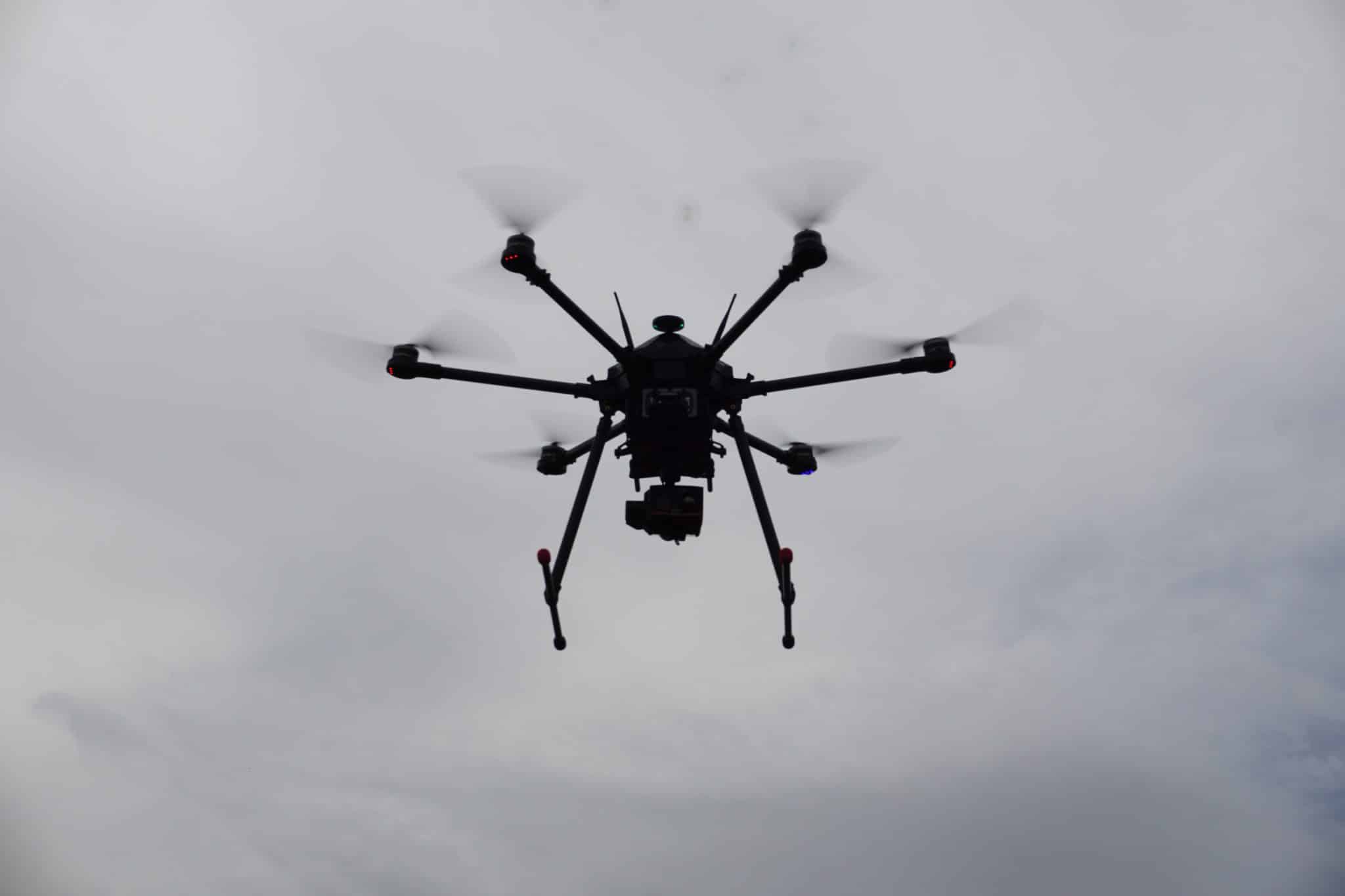
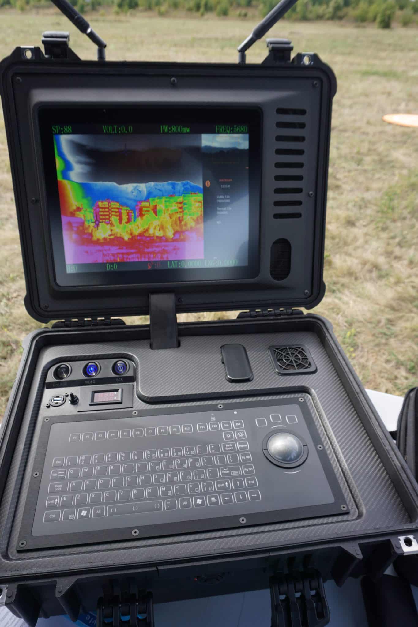

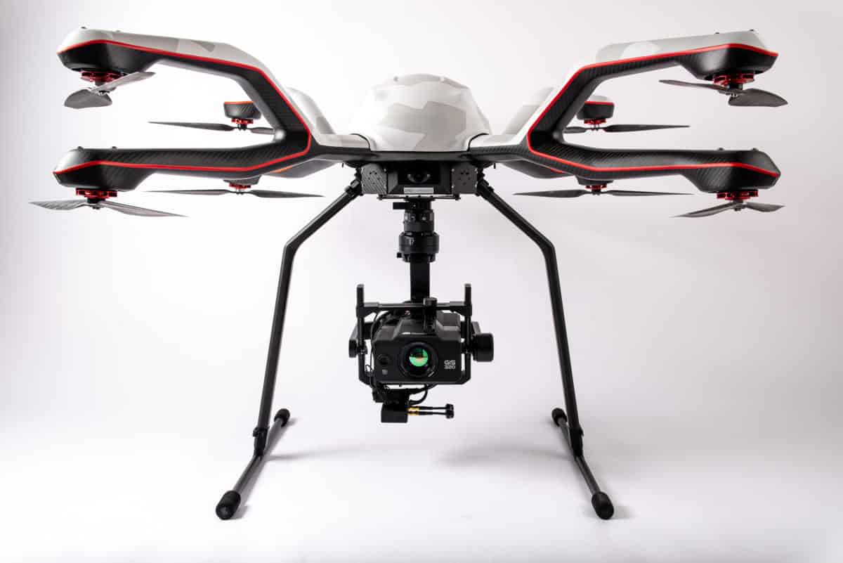
AV-X6 “Scorpion” – Multipurpose UAV
In 2016, during the Technical Fair in Plovdiv, Aero Vision Ltd presented an AV-X6 multirotor with a long flight duration and a maximum take-off weight of 16 kg. The multirotor machine, equipped with a radioactive intelligence container, a ground control station and telemetry data transmission in real time, was awarded a gold medal in the category “Ecology and Energy” during the exhibition.
Following the success of the exhibition, Aero Vision Ltd developed a new, optimized version of the proven machine with increased efficiency and advanced capabilities – AV-X6v2.
In 2022 Aero Vision EOOD also developed a new improved version of the already proven “Scorpion”, providing the possibility of a longer flight duration, equipped with additional sensors and equipment on board.
Part of the innovative solutions include telemetry data transmission over long distances (up to 80 km) and encrypted connection for better data protection.
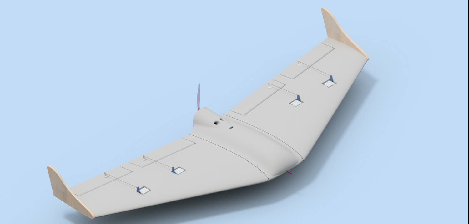
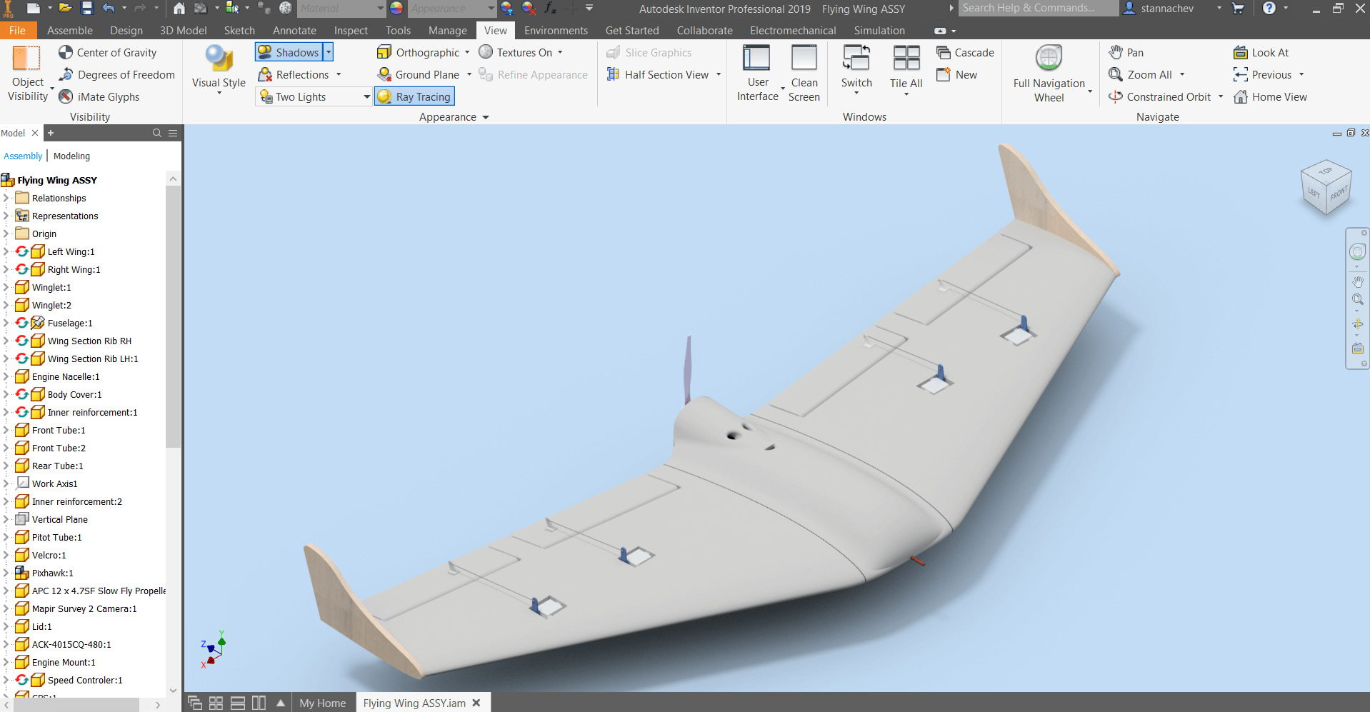
Flying wing EagleEye
In 2018. Aero Vision Ltd has developed the latest masterpiece in the field of unmanned aircraft – EagleEye.
The flying wing has proven its superior flying performance, delivering high efficiency, low drag and long flight endurance. The flying wing developed by Aero Vision Ltd is used for large areas and is suitable in sectors such as construction and agriculture. Increased efficiency of EagleEye provides fast, accurate mapping of high altitude areas, optimization of post-processing time and analysis of results.
The internal volume of EagleEye enables the installation of a wide range of cameras and sensors, which further extends the flying wing and its efficiency.


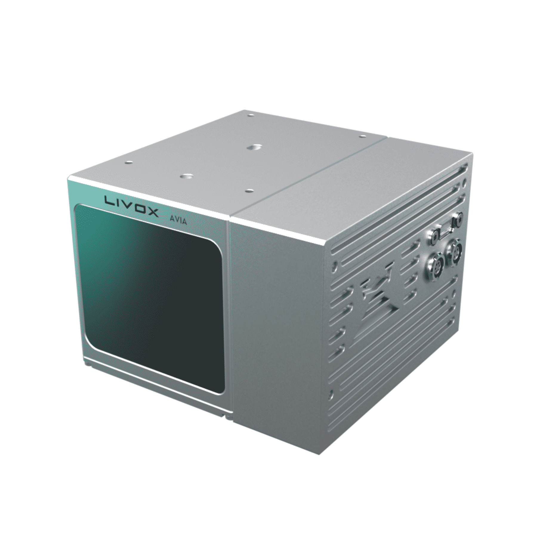
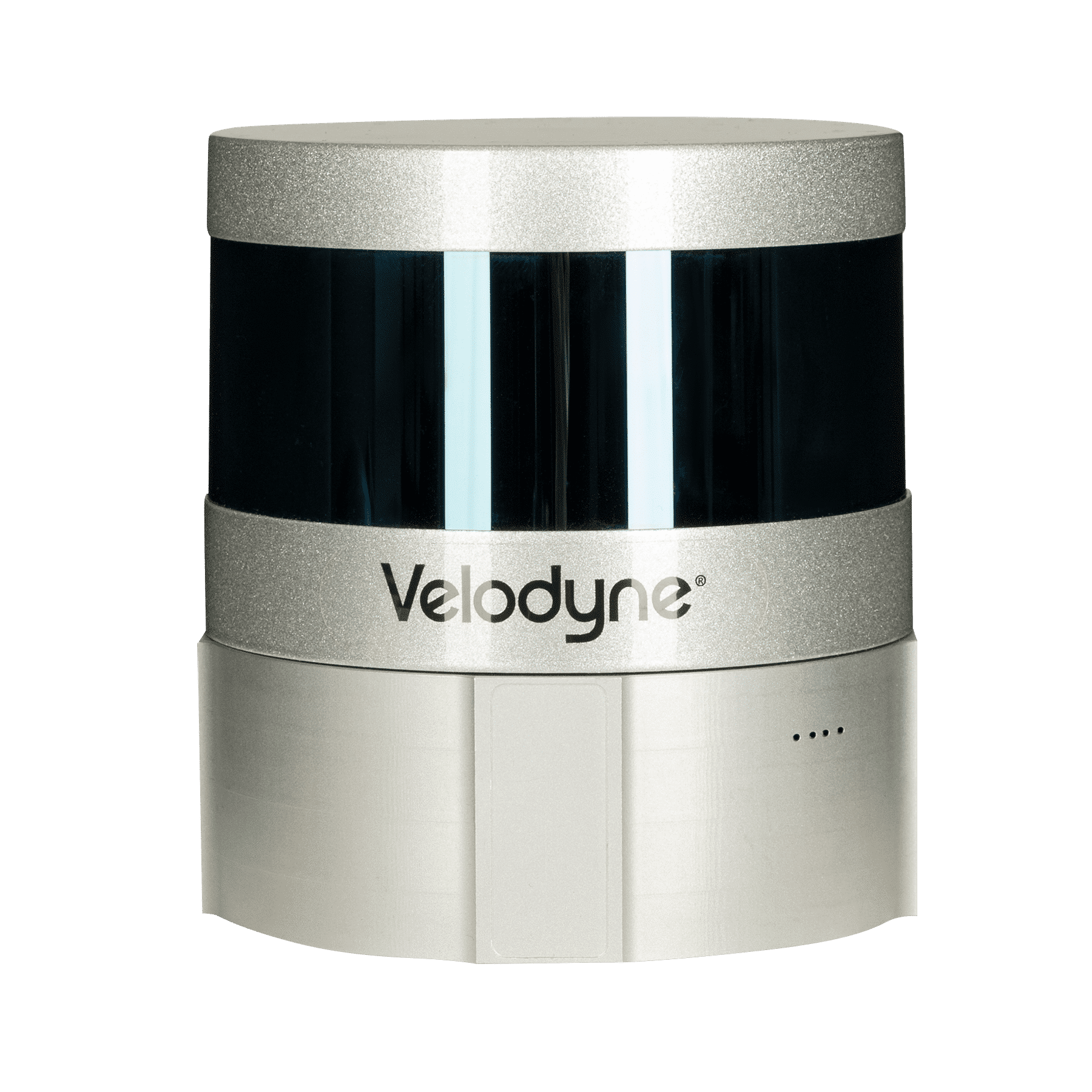
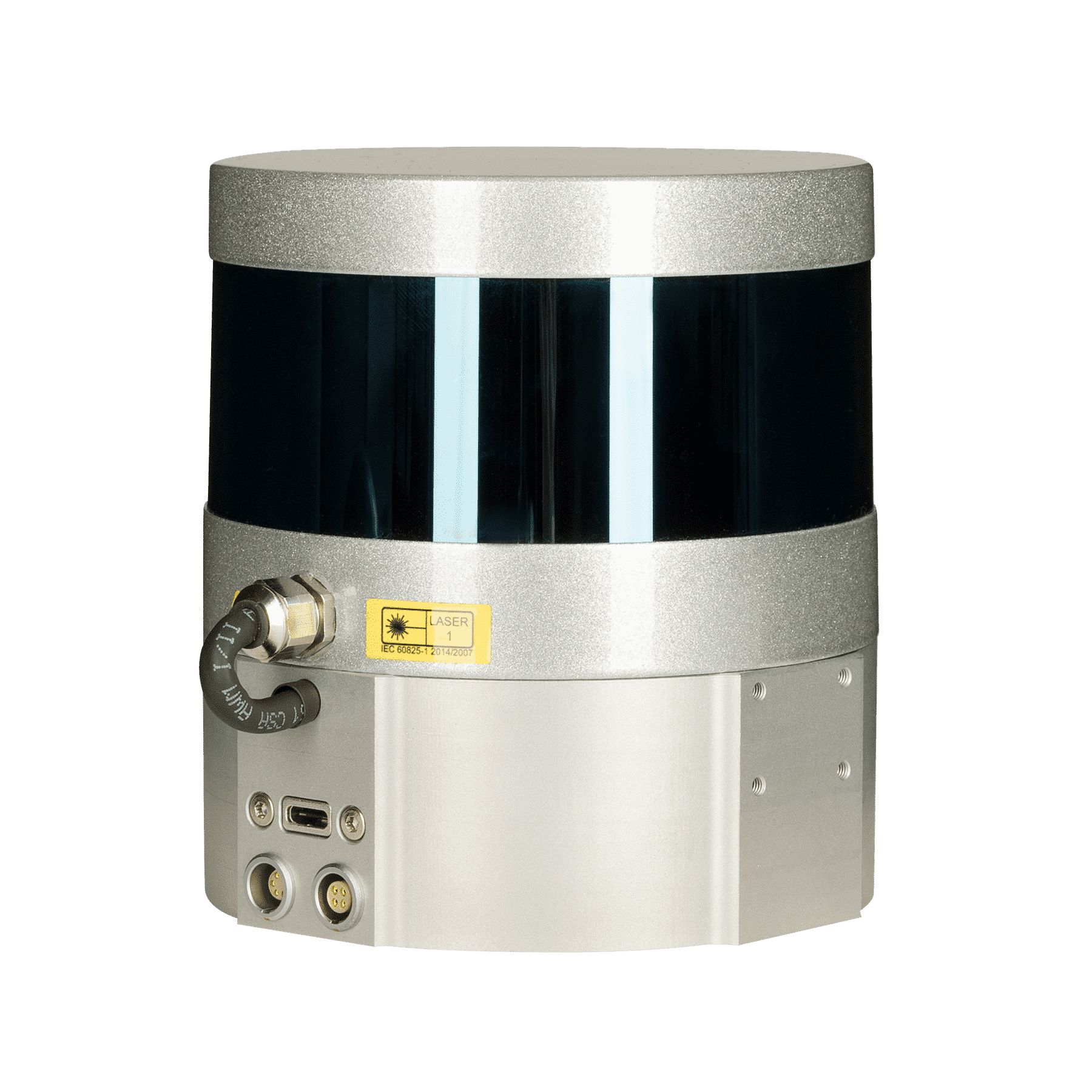
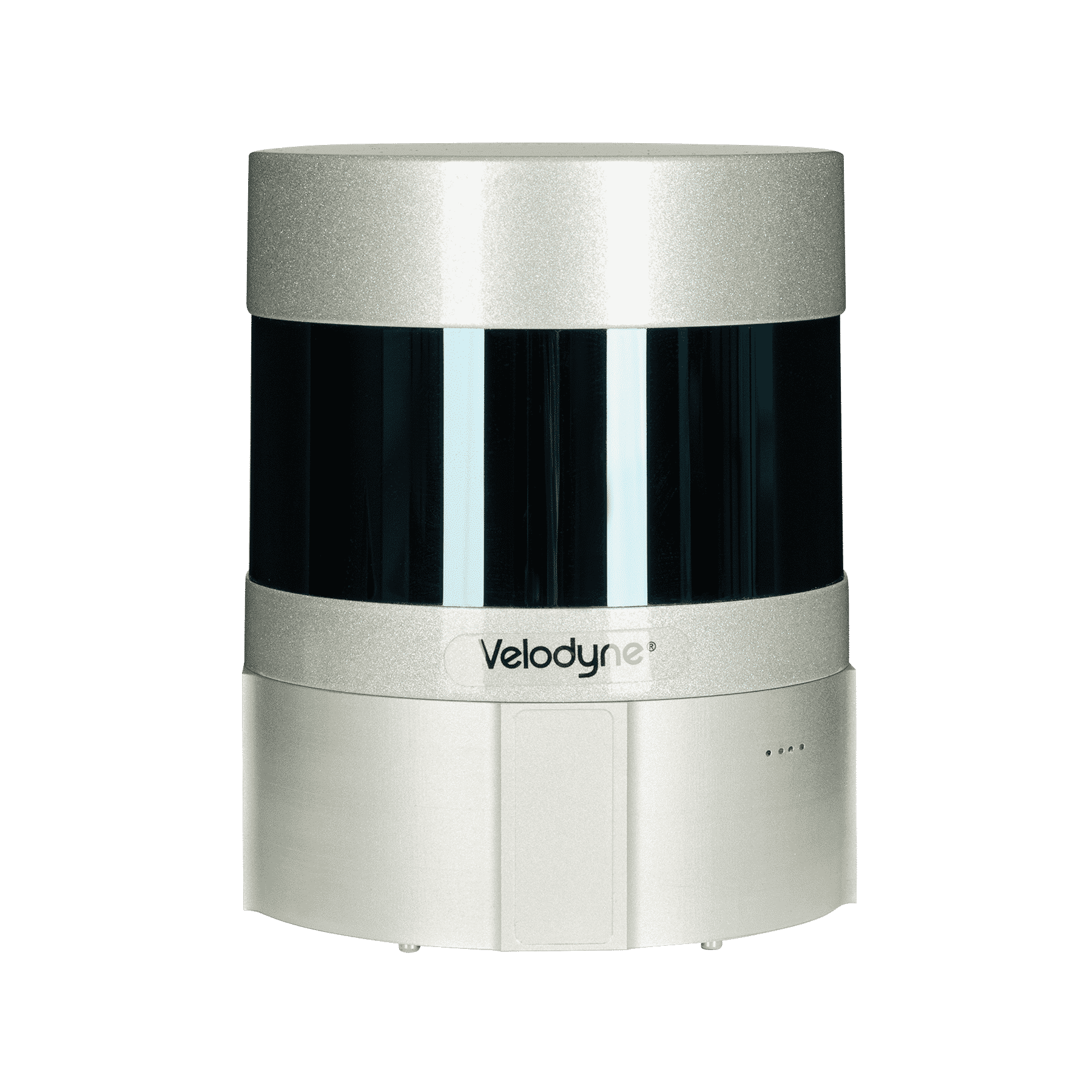
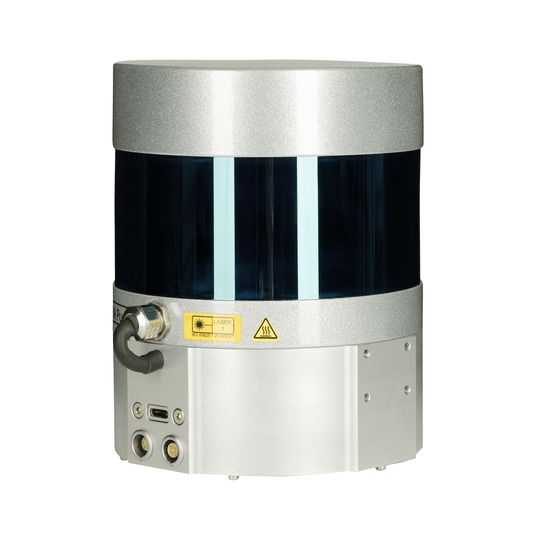


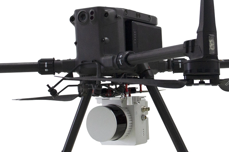


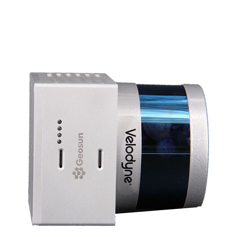
3D LiDAR scanners from TOPODRONE and GEOSUN
TOPODRONE offers products with Swiss precision and quality at the lowest price on the market for LiDAR solutions and aerial mapping.
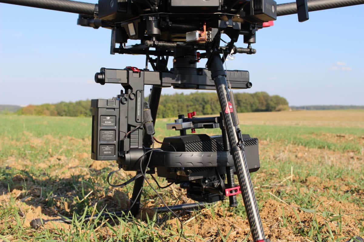
Together with the AV-X6v2 Scorpion, we offer flight-ready unmanned systems with an optional GNSS receiver connected to a modified and calibrated camera, everything you need to obtain high-precision photogrammetry data up to 3 cm in XYZ without the use of ground-based control points. (GCP).
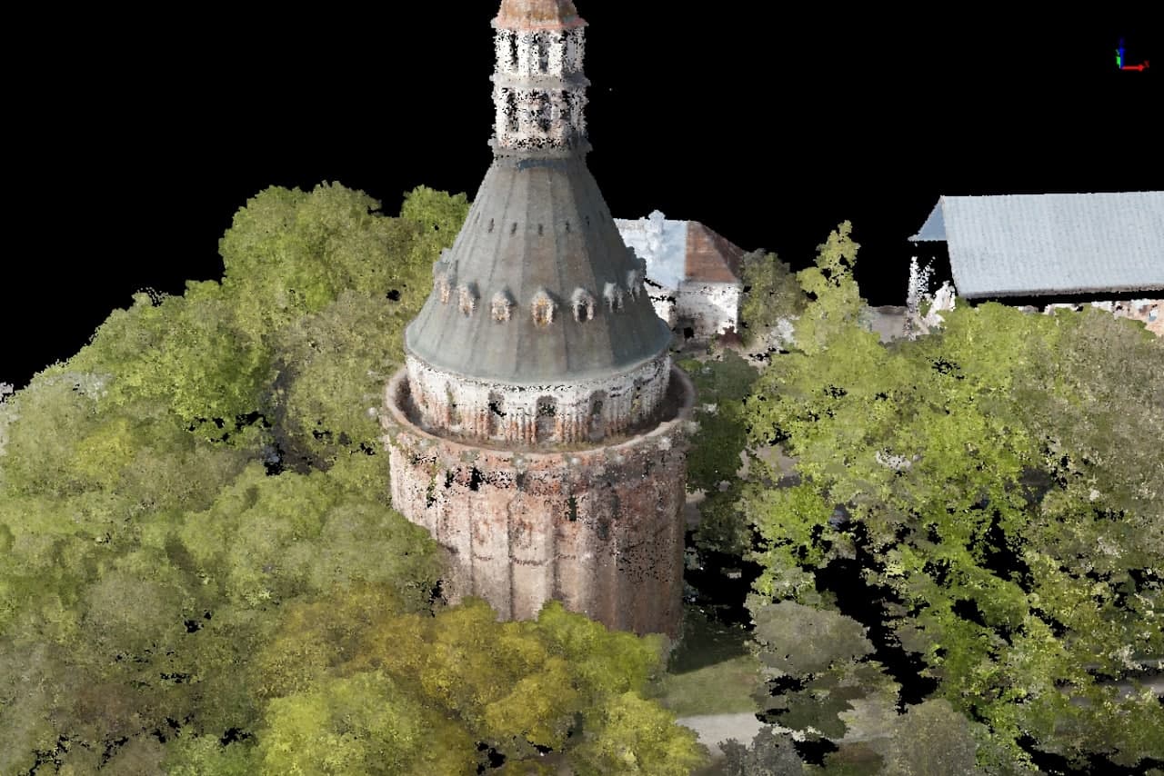
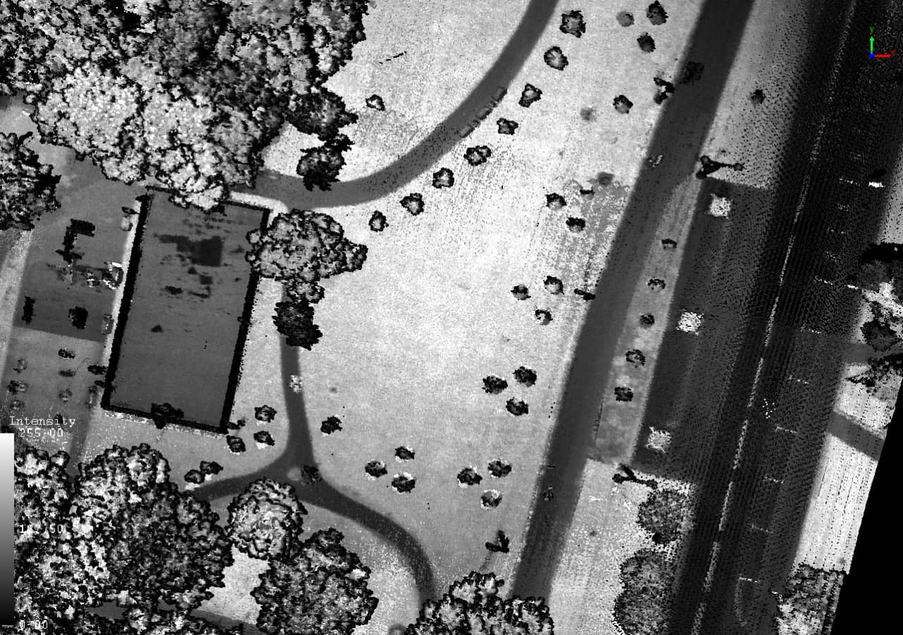
GEOSUN products provide an opportunity to easily and quickly scan various objects from the earth’s surface, and through the use of the specialized gAirhawk software, fast, accurate and reliable post-processing of the data is realized.
You can take aerial photos with a resolution of up to 1 cm per pixel and easily transform them into high-precision orthomosaic and 3D models in automatic mode combined with the LiDAR data.
Built in survey grade L1/L2 Multi-band RTK/PPK GNSS receiver connected via advanced synchronization system with the camera turns your drone to professional survey tool.
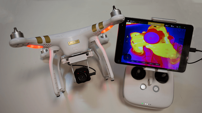
Workswell thermal imaging cameras and solutions
Products and systems from Workswell are utilized in the manufacturing process for numerous European car manufacturers. If you drive a recent model from BMW, Skoda, Renault and Kia, it is likely that Workswell’s thermal imaging systems has been used to manufacture some of your car’s components. For sure, Workswell has also many customers outside the car manufacturing industry. To name a few of these: Bosch, Honeywell, Tesco, Heineken, Kofola, IKEA, Net4Gas, Semikron, ArcelorMittal, as well as many other companies of varying sizes and focus.
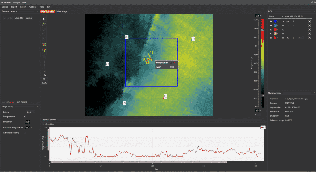
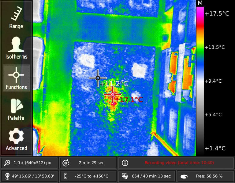
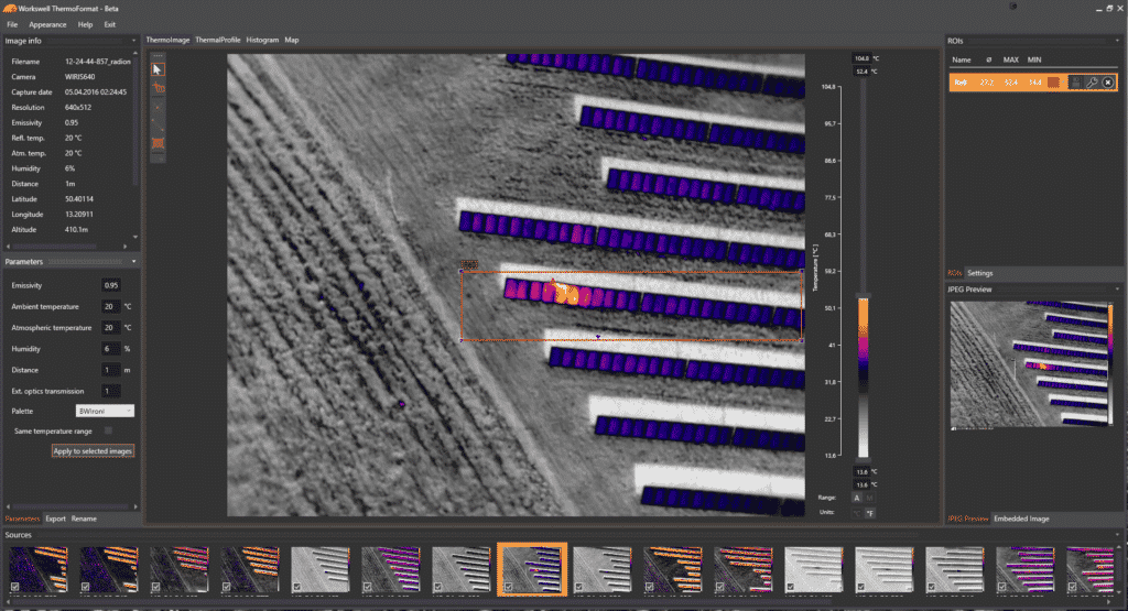
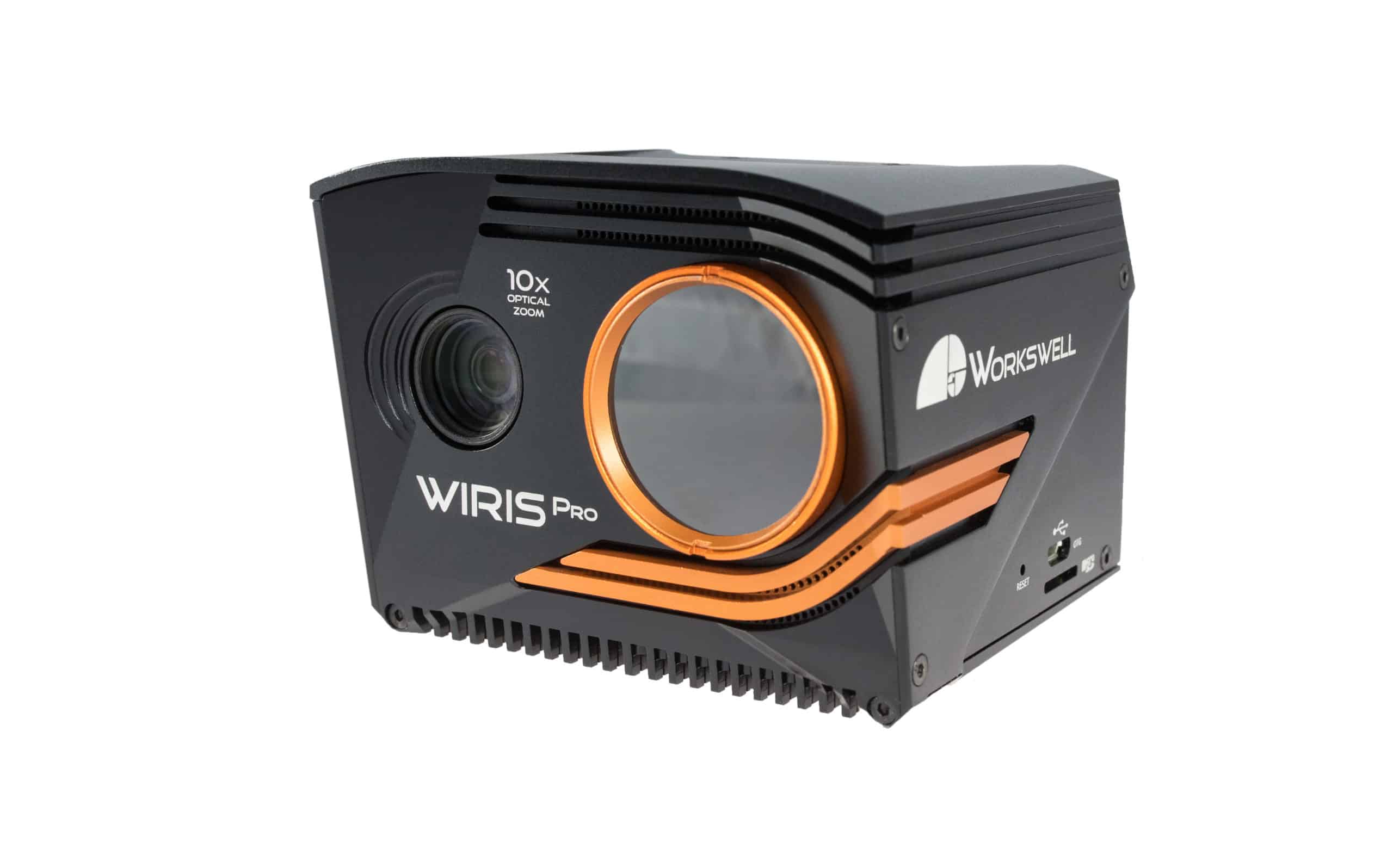
Workswell WIRIS® Pro has been designed first and foremost as an inspection camera. Its thermal camera is equipped with a LWIR micro bolometric sensor with 640×512 px resolution (in the 7.5 – 13.5 μm range) and the Super resolution mode functionality providing an option to have the final thermogram in the 1266 x 1010 px resolution. The RGB camera comes with a Full HD (1920 x 1080 px) resolution and, most importantly, it provides an absolutely unrivalled optical ultrazoom – as much as 10x. The highest possible temperature that the thermal camera can measure is 1.500 °C. High measurement accuracy and precision metrology. We are aware that industrial applications can be very demanding when it comes to metrology and that at each stage. Each thermal camera is precisely and individually manufactured and calibrated.
Workswell WIRIS ProSc is a state-of-the-art thermal imaging camera used for the most challenging applications like a geological, archeological and forest research, ecological and environmental research, structural research of buildings (dams, chimneys, bridges) etc. Workswell WIRIS ProSc camera is designed for applications requiring the highest temperature sensitivity and accuracy, excellent service and software support. That’s why the camera is offered in a research and education kit with WIRIS Data SDK for user’s application development and WIRIS Ethernet SDK for ethernet application development.
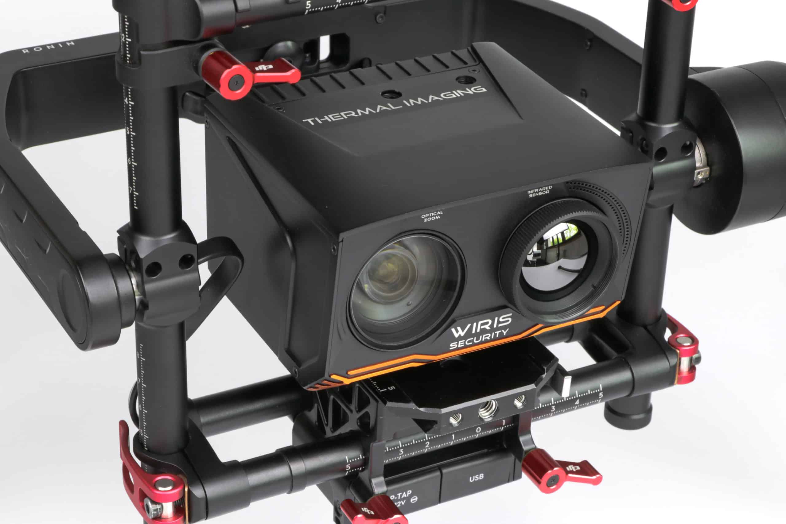
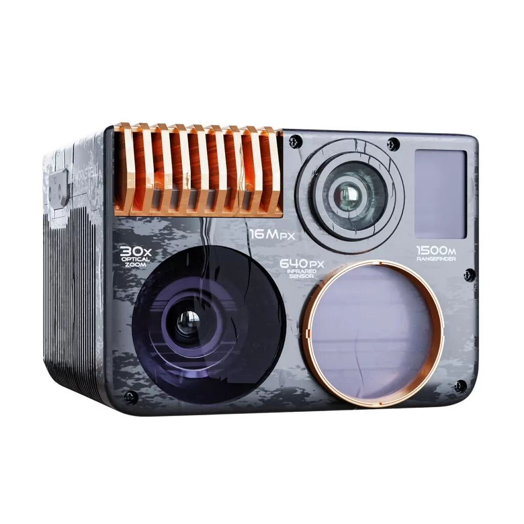
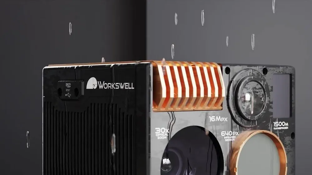
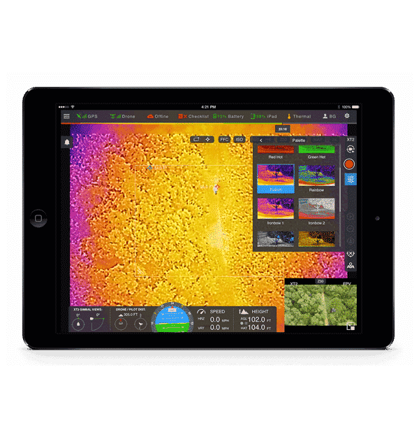
The latest Workswell WIRIS® Enterprise camera completely replaces the Workswell WIRIS® Security, which is a LWIR (7.5 – 13.5 µm) drone thermal camera designed specifically for search and rescue applications such as building and perimeter surveillance, searching for missing persons, firefighting operations, etc. This thermal camera is fully adapted to these applications with a high-resolution sensor (1266 x 1010px), 30x optical zoom in the RGB spectrum, two RGB cameras, laser rangefinder (up to 1500m), search and rescue functions, excellent temperature sensitivity, as well as a strong mechanical construction made of lightweight aluminium.


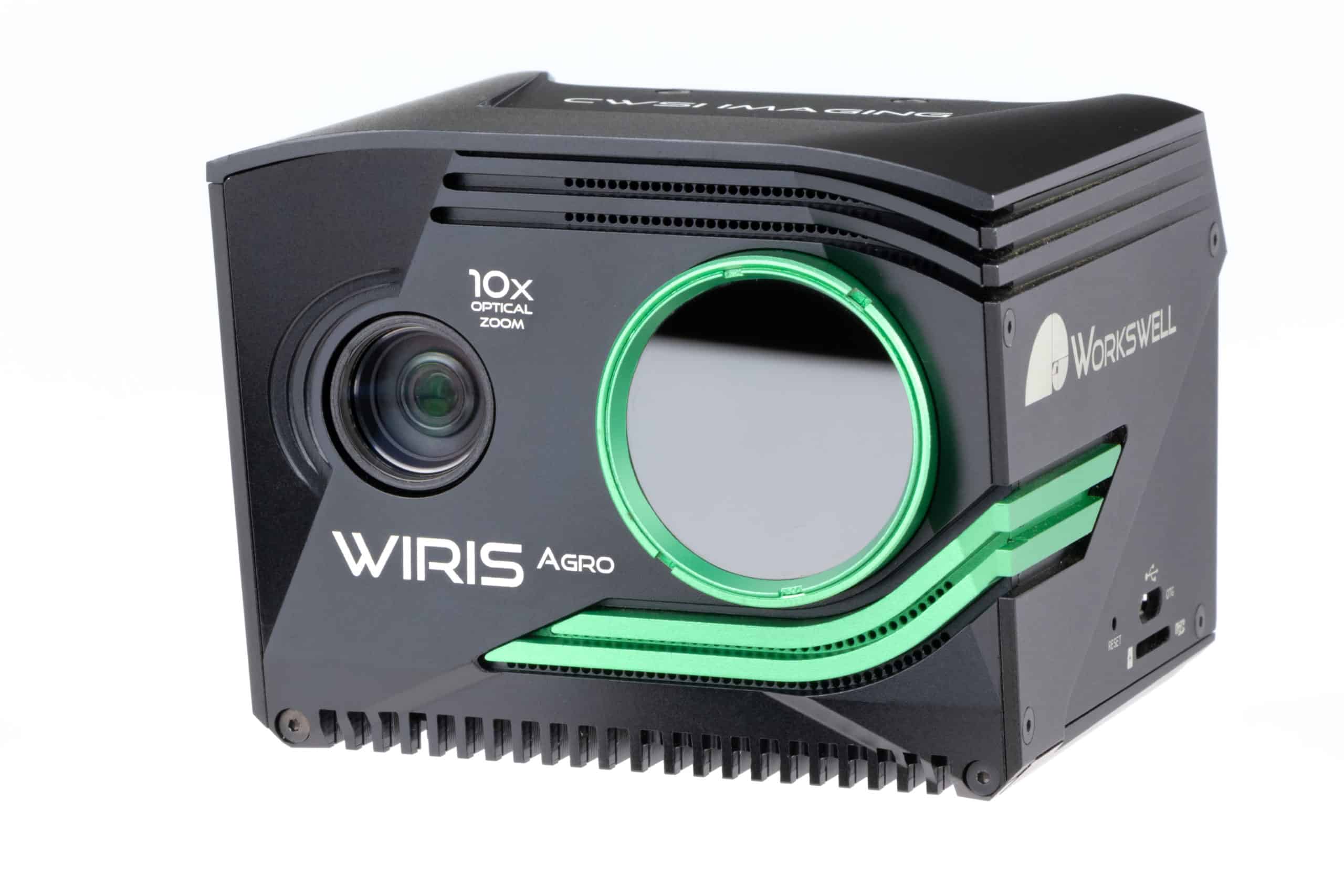
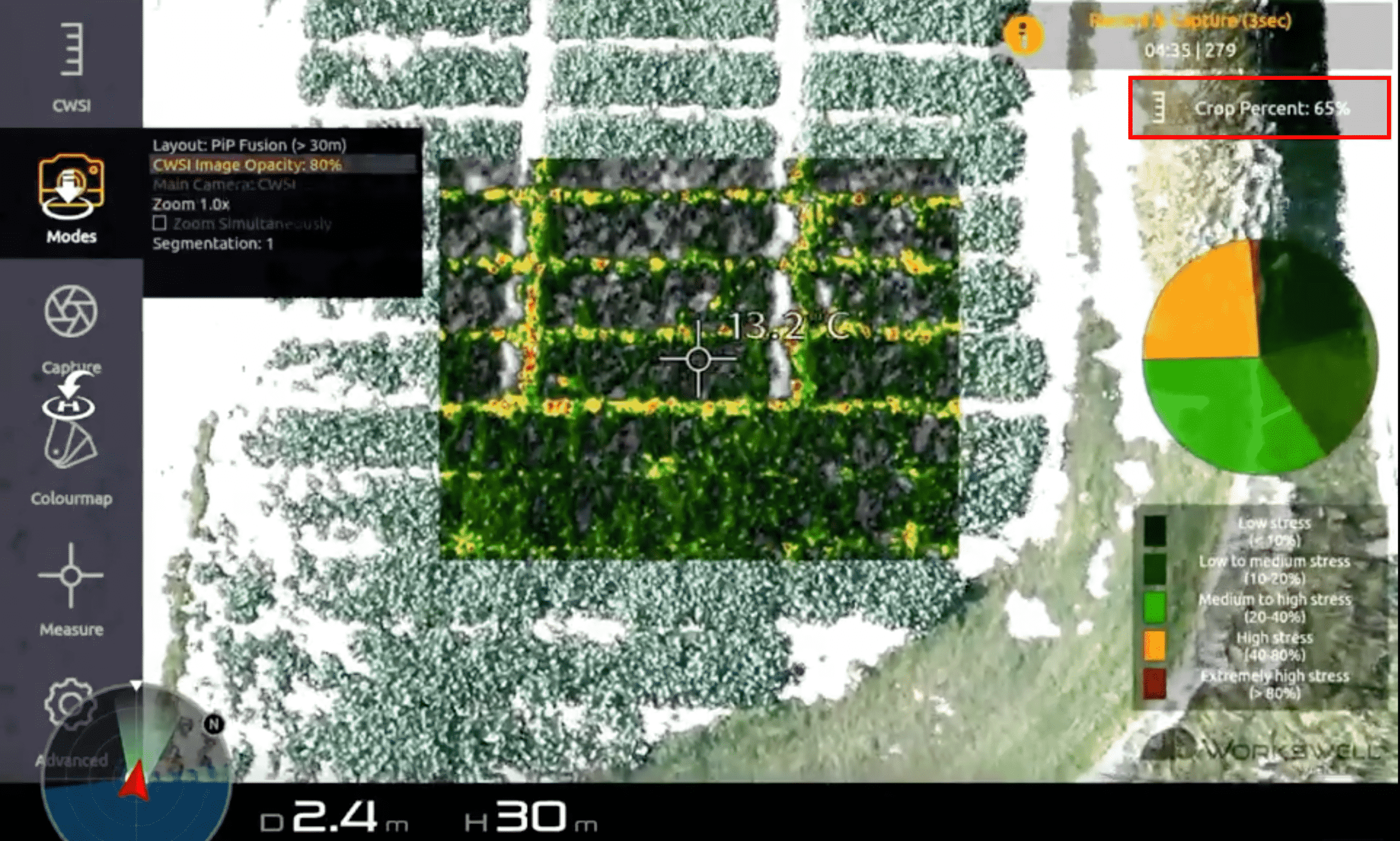


Workswell’s WIRIS Agro is the first device of its kind designed to map water stress across large areas in the field of precision agriculture. The aim of this method and device is to determine the value of water stress in the plant stand. Crop drought – actual and real value. In the dry season what we are usually interested in is the actual effects of drought on crops. These impacts are not only dependent on the condition of the so-called climatic drought, but also on the groundwater drought, the size of the plant root system, etc. Measuring the water stress of plants with CWSI (Crop Water Stress Index) camera will help you to determine the actual and real effects of drought on the crop.
Under certain circumstances, infra-red cameras are highly useful for detecting specific gas escapes and the presence of certain gases in the air. They can be also helpful during tests on improving environmental safety. Workswell GIS-320 is a perfect solution to detect gas leaks. The combination of a thermal and digital camera brings you the opportunity of environment protection as well as human health and safety! Wide spectrum of detectable gases. The GIS-320 can detect a wide spectrum of gases, which are invisible to a human’s eye. The GIS-320 has a high sensitivity with a range of detection between 3.2 – 3.4 μm.
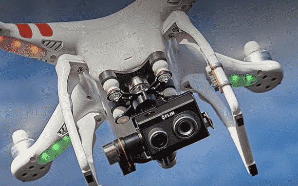
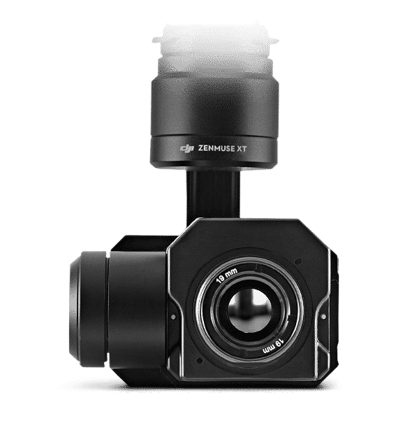

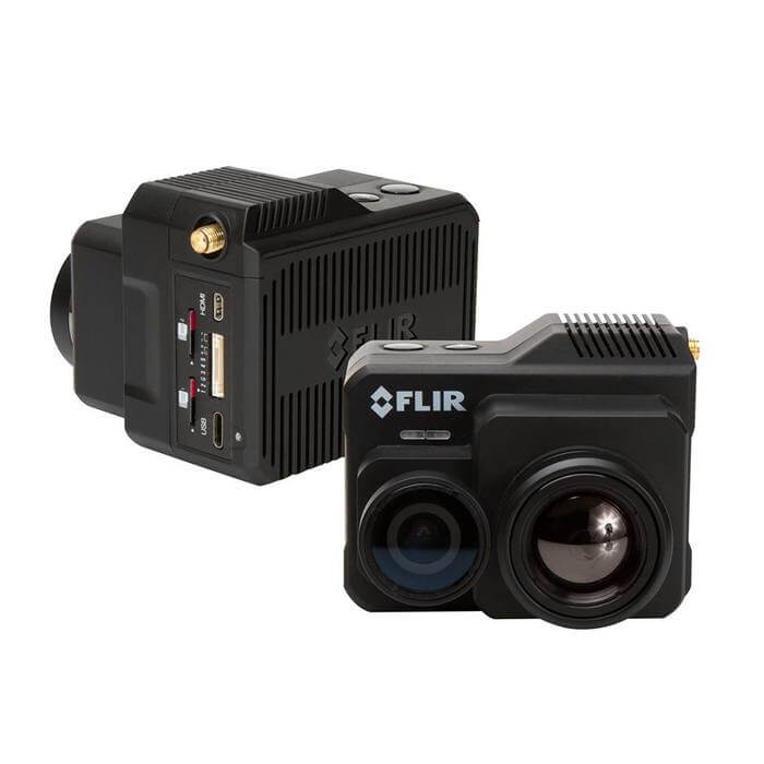


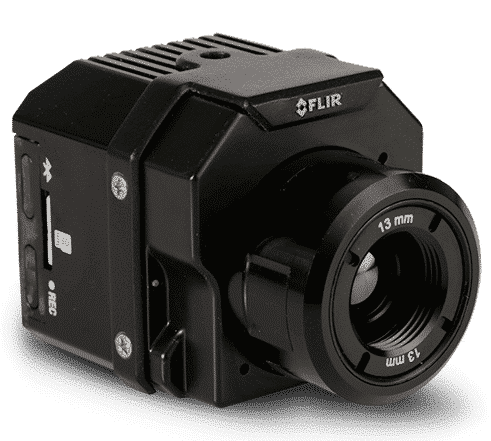

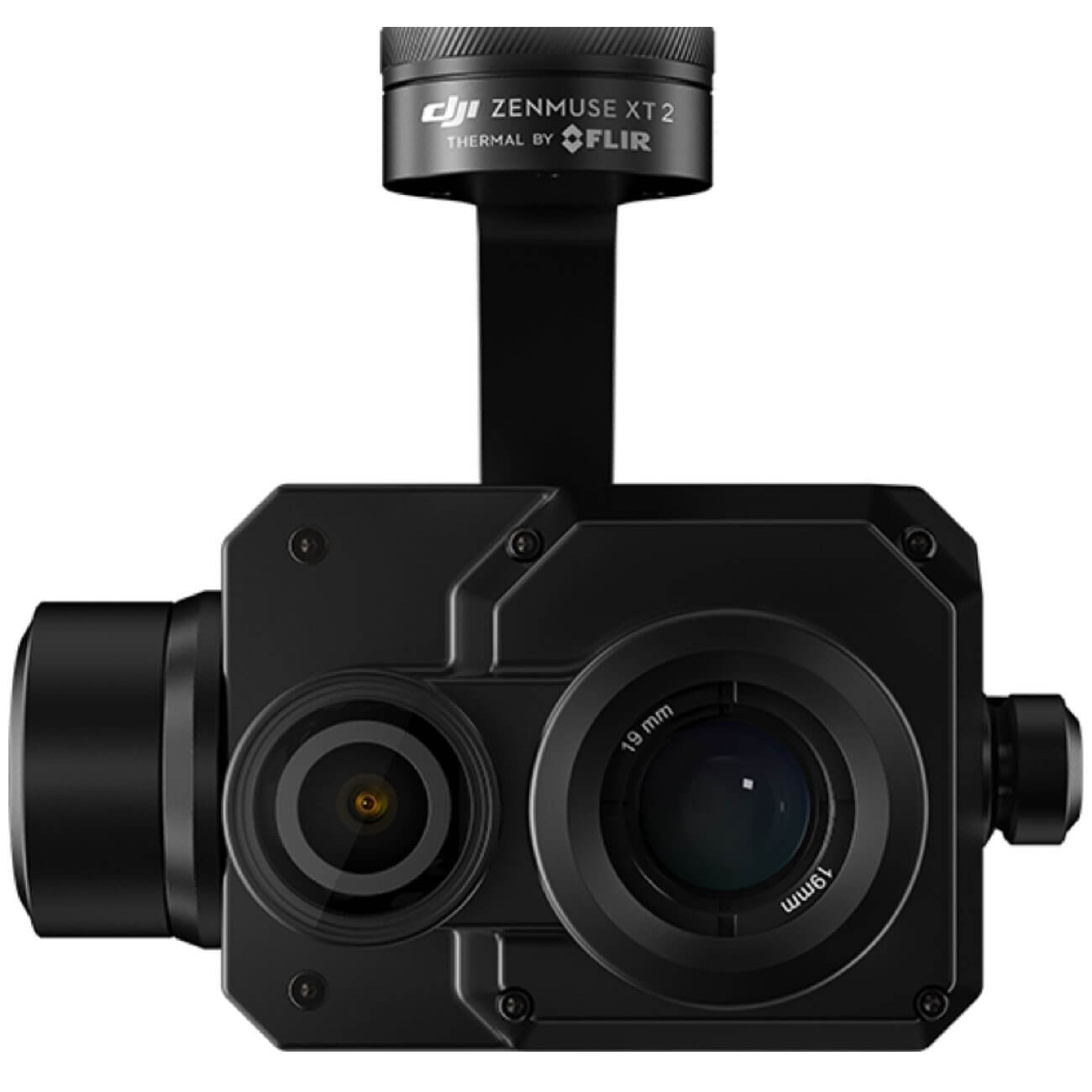

FLIR thermal imaging cameras
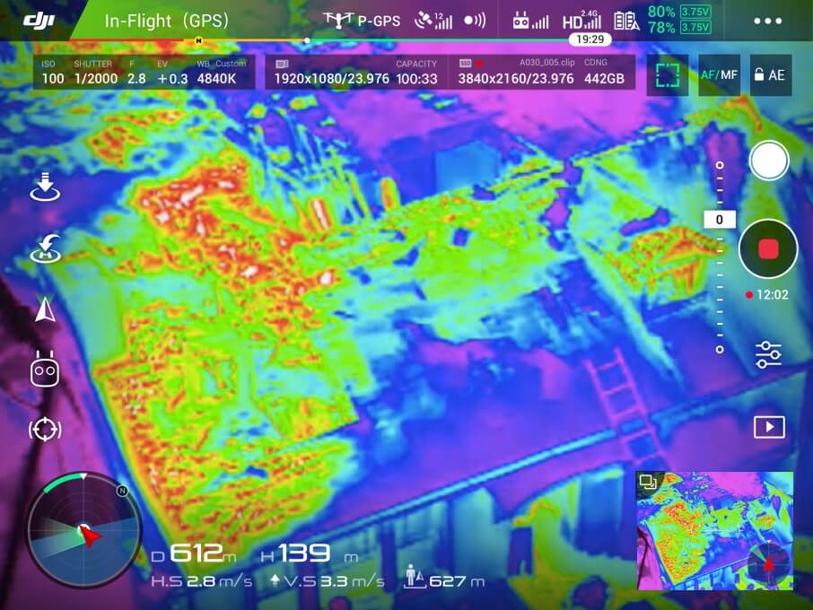
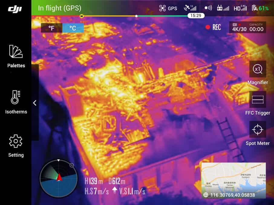
Building status information before purchasing is critical to customers, and FLIR thermal cameras are the ideal tool for identifying poor insulation and moisture problems as well as roofing problems. By combining a gyro-stabilized platform, ground control station and telemetry real-time imaging, FLIR products provide the best solution for reliable and fast remote monitoring.
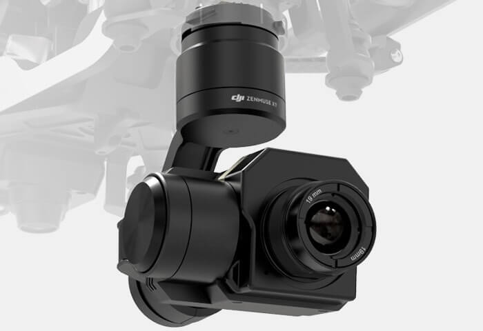
The portfolio includes the full range of FLIR cameras such as Zenmuse XT, Zenmuse XT 2, FLIR Vue Pro and FLIR Duo Pro, which are ready to meet the highest demands and have the ability to be mounted on most of the industrial multirotor systems on the market.
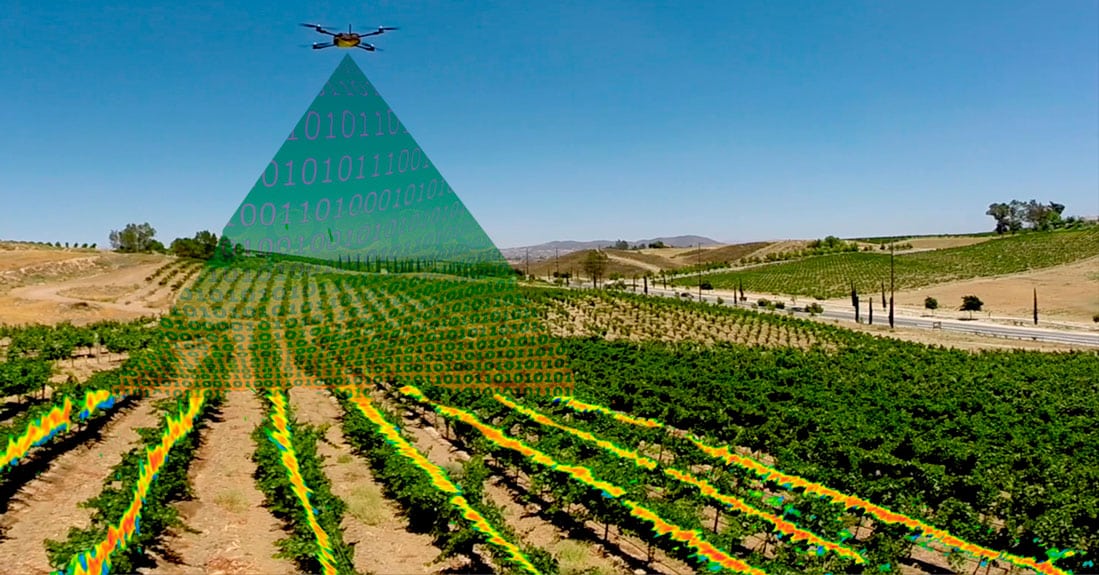
Specialized cameras for precision agriculture
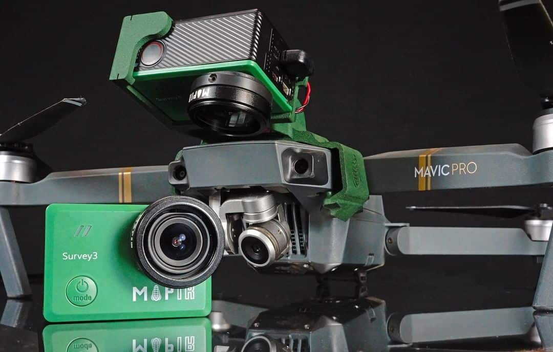
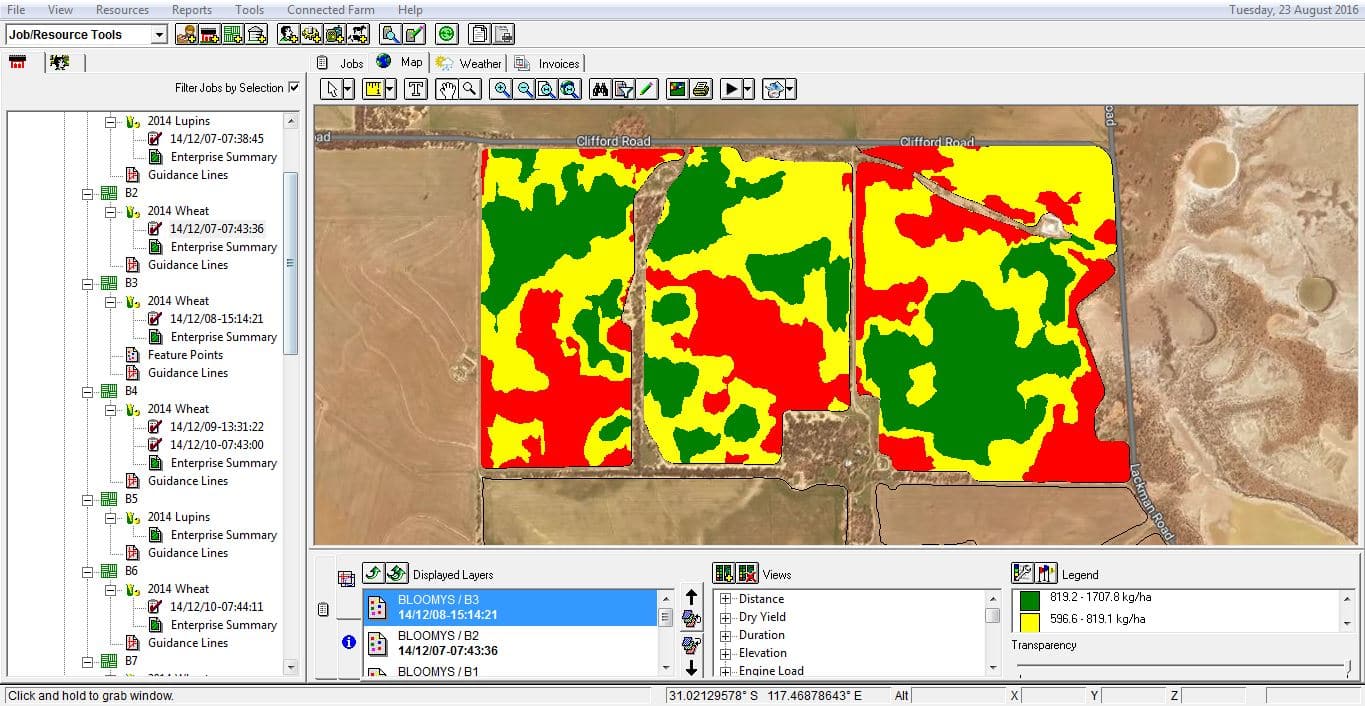
From 2017 Aero Vision Ltd is an official importer of the specialized remote monitoring and analysis solutions provided by the leading manufacturer of NDVI cameras – MAPIR.
The portfolio of precision farming cameras includes a wide range of multi-spectral cameras and cameras with a wide range of filters and lenses (RGB, OCN, NGB, Red-Edge, NIR, NDVI, eNDVI).
The broad possibilities for analyzing sown areas and plant condition are provided by reliable and proven MAPIR sensors: Survey3 and Kernel.
Survey3 is available both in wide-angle (Survey3W) and narrow-angle versions (Survey3N). Both lenses have no fish eye effect and extremely low distortion, providing excellent results in air monitoring and mapping. Survey3W is similar to most DJI cameras (Mavic, Phantom, Inspire X3). Survey3N provides 2X Optical Fixed Zoom vs. Survey3W, providing 2X higher ground-based resolution (GSD).
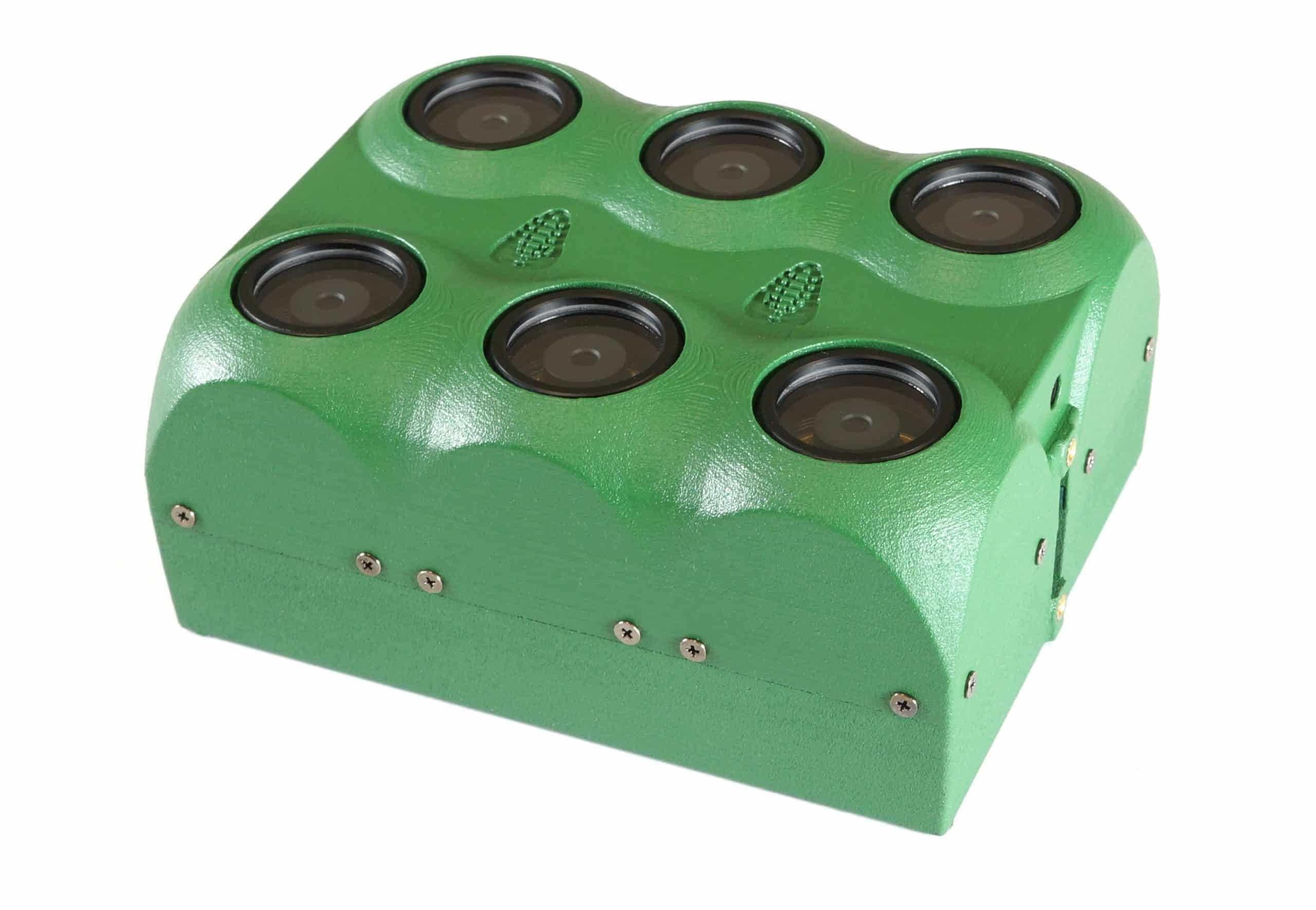
The Kernel camera is the first modular platform, with all individual cameras easily coupled together to form custom, compact photo frames. You can configure each camera module with a variety of sensors, lenses and filters, making it easy to adapt to the requirements of the current project. Ideal for manufacturers, integrators and UAV operators who want to build powerful, customized, multi-spectral cameras and cameras for NDVI and eNDVI analysis.


Specialized software for photogrammetry
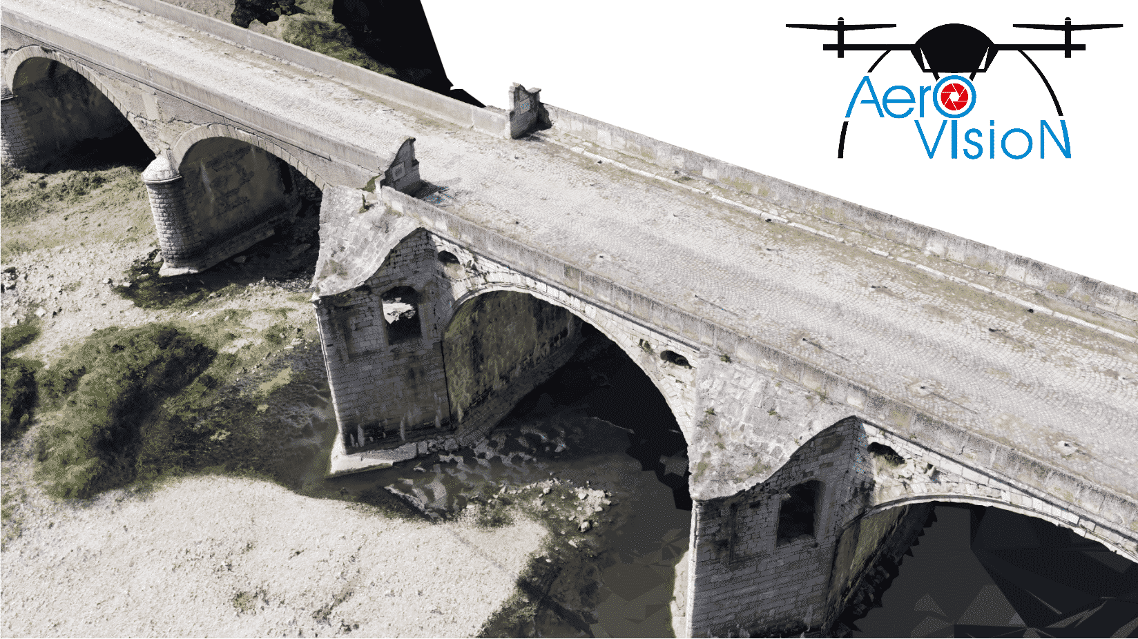
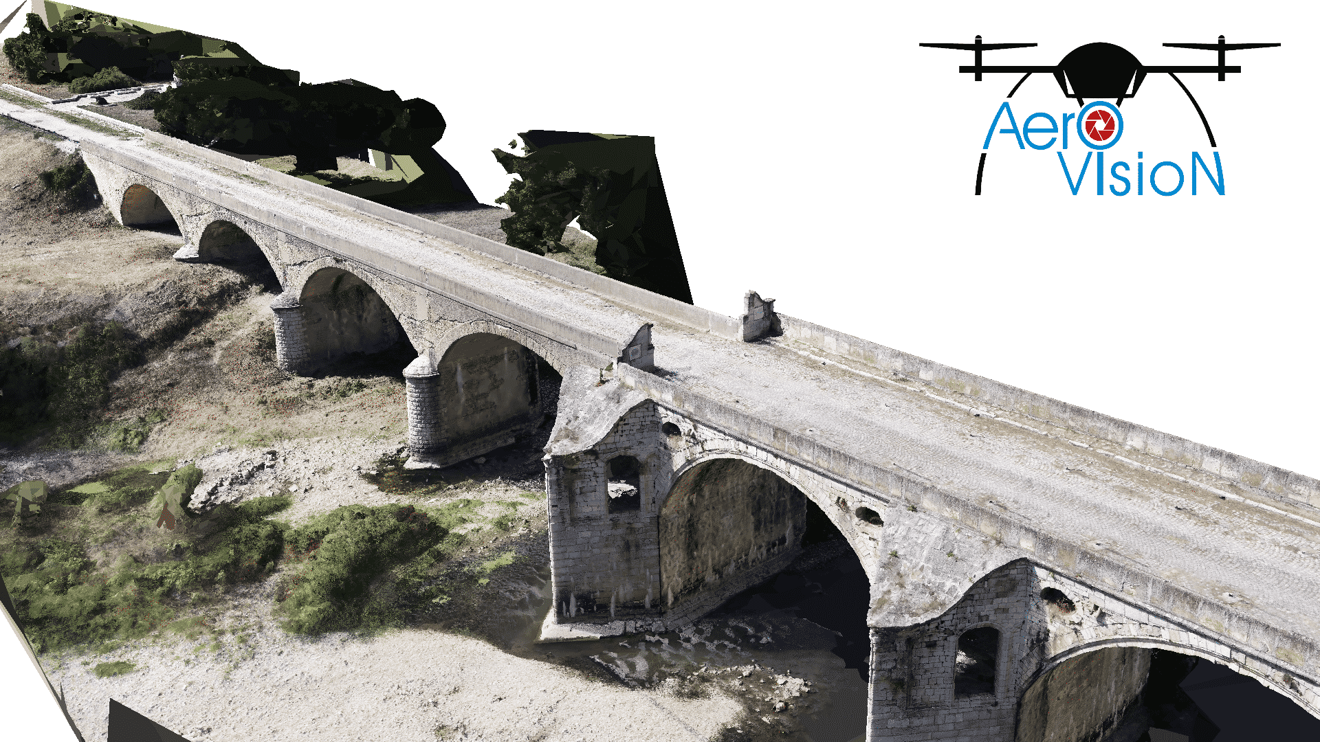
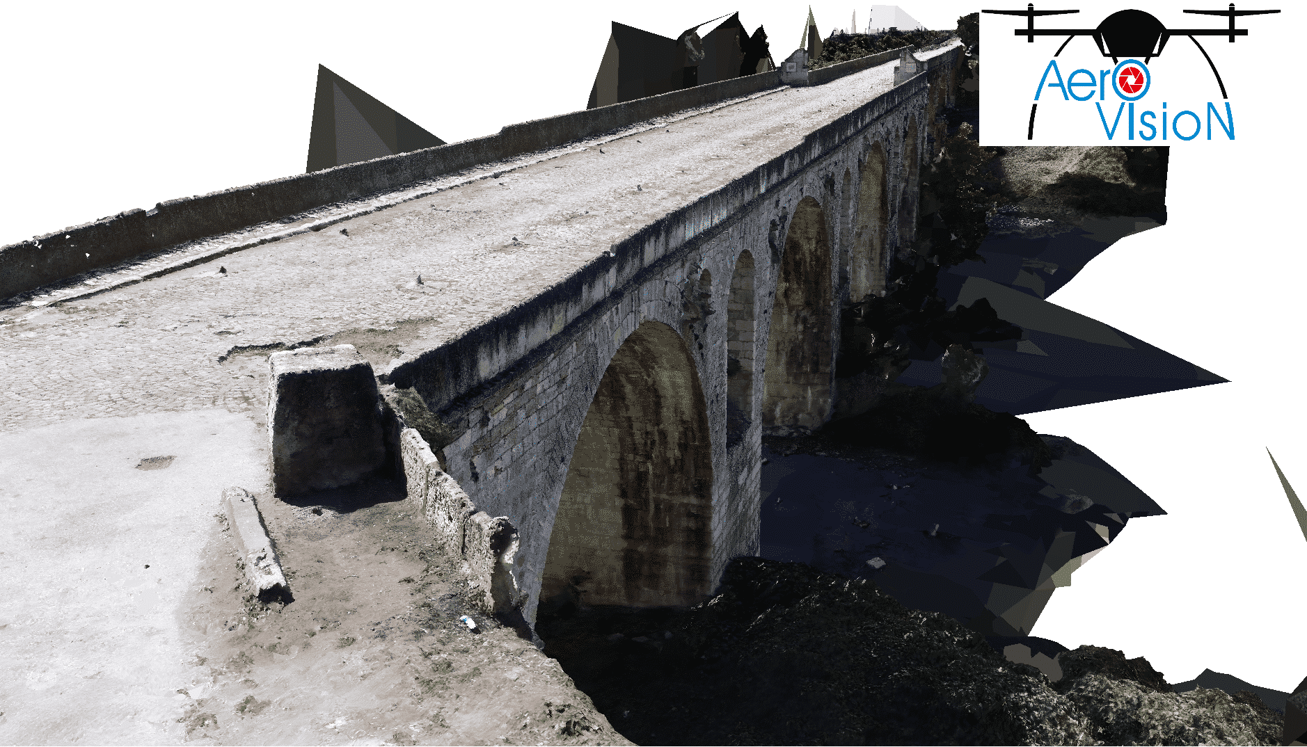
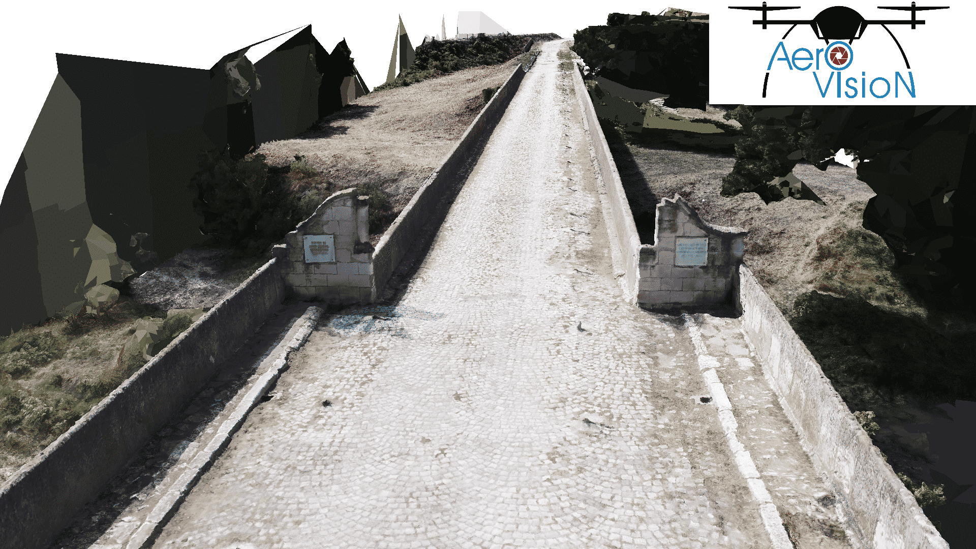
From September 2020, Aero Vision Ltd became official reseller of Reality Capture for Bulgaria.
RealityCapture is the state-of-the-art photogrammetry software solution that is changing the industry.
It is currently the fastest solution on the market, which brings effectivity to your work and allows you to focus on your targets.
Create virtual reality scenes, textured 3D meshes, orthographic projections, geo-referenced maps and much more from images and/or laser scans completely automatically.
Inspect your data directly in the field and add missing photos. Leave the job site with ready data. Process 3D models from 400 photos on a standard laptop in 10 minutes. RealityCapture’s low hardware requirements allow you to check your data anywhere. Direct support of PPK/RTK flight logs dramatically reduce the users work directly in the field and post-processing time in RealityCapture.
Specialized software solutions from Pix4D
Pix4D is a market leader in photogrammetry software technology. Our products enable you to digitize reality and measure from images taken from planes, drones, phones, or any other camera.
We revolutionize photogrammetry, so you can scale up and unleash the power of your imagery.
Research is in our DNA. It was there when we were founded back in 2011 and it’s still a priority today.
We believe that R&D is the key to pushing the boundaries of modern photogrammetry. Our team includes scientists, engineers, and photogrammetry specialists.
PIX4Dmapper‘s photogrammetry algorithms transform your ground or aerial images in digital maps and 3D models. Seamlessly process your projects on your desktop using our photogrammetry software, or bundle with PIX4Dcloud for online processing. It provides compatibility and import with RGB, thermal, or multispectral images with any camera or drone.
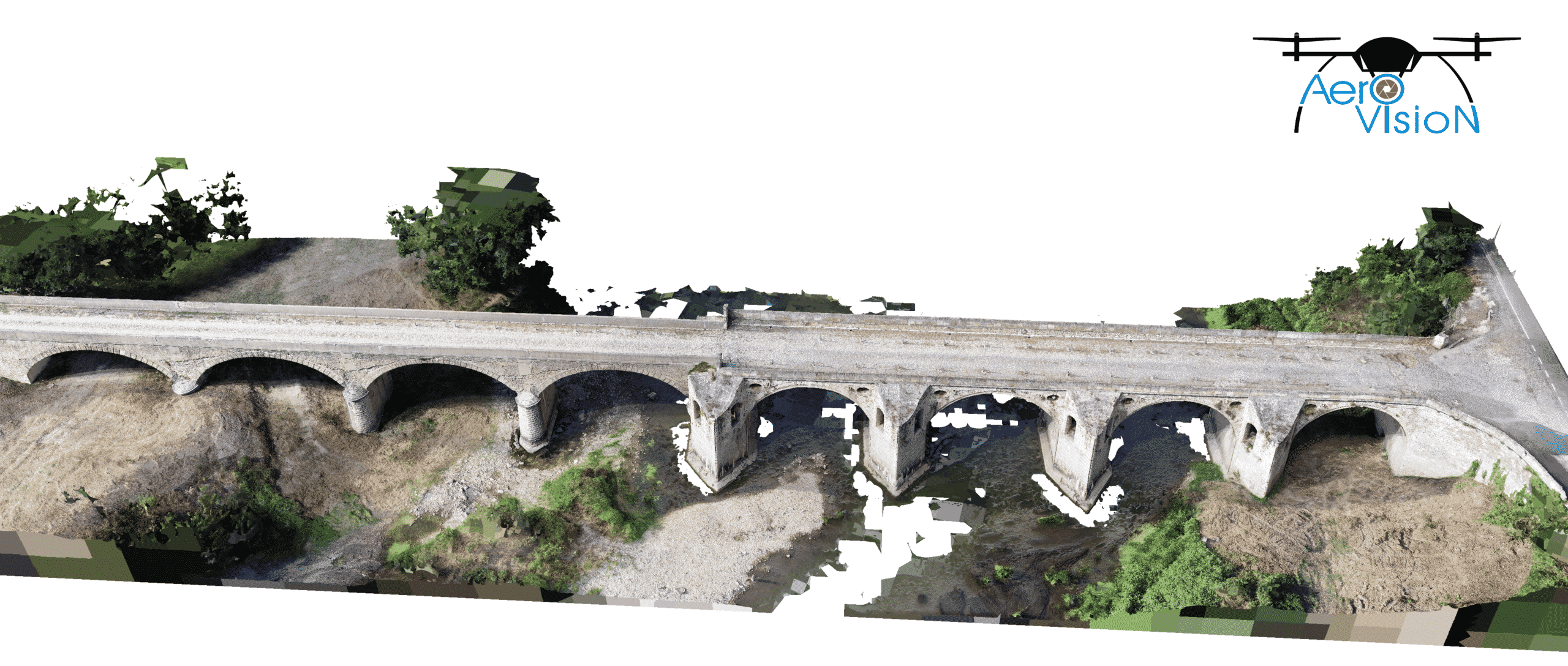
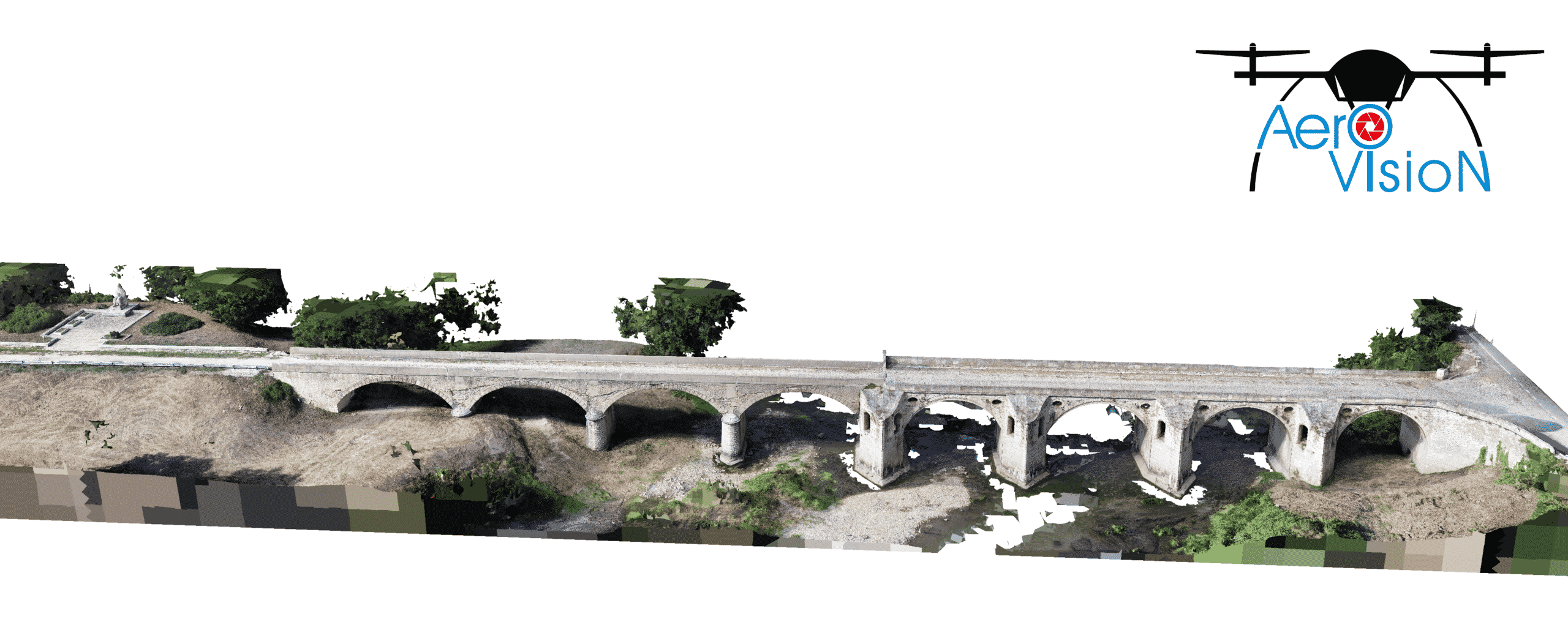
Pix4Dsurvey provides capabilities for import of large files and datasets, as well as LiDAR scans. It works with multiple point clouds at the same time formatted as .las or .laz files and provides industrial grade photogrammetry tools, like special algorithm for clearing noise and objects from the scene (for example photogrammetry of a highway with a heavy traffic).
Pix4Dmatic is the next-generation photogrammetry software for terrestrial, corridor and large-scale mapping. It processes thousands of images while maintaining survey-grade accuracy, halving the processing time, without the trouble of splitting and merging.


Pix4Dcloud is an online platform for ground and drone mapping, progress tracking, and site documentation. It relies on Pix4D’s processing algorithms to get the survey-grade results you expect. Choose the AutoGCPs feature for even greater accuracy. The cloud solution provides higher flexibility and efficiency without investing in expensive hardware equipment.
Pix4Dfields is the ideal solution for every agronomist and farmer. It provides compatibility with RGB and multispectral images for accurate and highly valuable NDVI data of the crops. Additionally, images and satellite data import is supported to enhance your mapping experience with Sentinel-2 satellite data.
Pix4Dinspect automate industrial inspection and asset management with intelligent digital twins. Inspect your asset with the original images and a detailed model, making annotations and accurate measurements with the help of AI. You will save time with the automatic reports and their easy export.
PIX4Dengine is a set of programming modules accessible via Application Programming Interfaces (APIs) and Software Developing Kits (SDKs) for extracting critical information from images, running on your infrastructure or on our cloud, and compatible with other Pix4D solutions.